Map of Pensacola, Florida
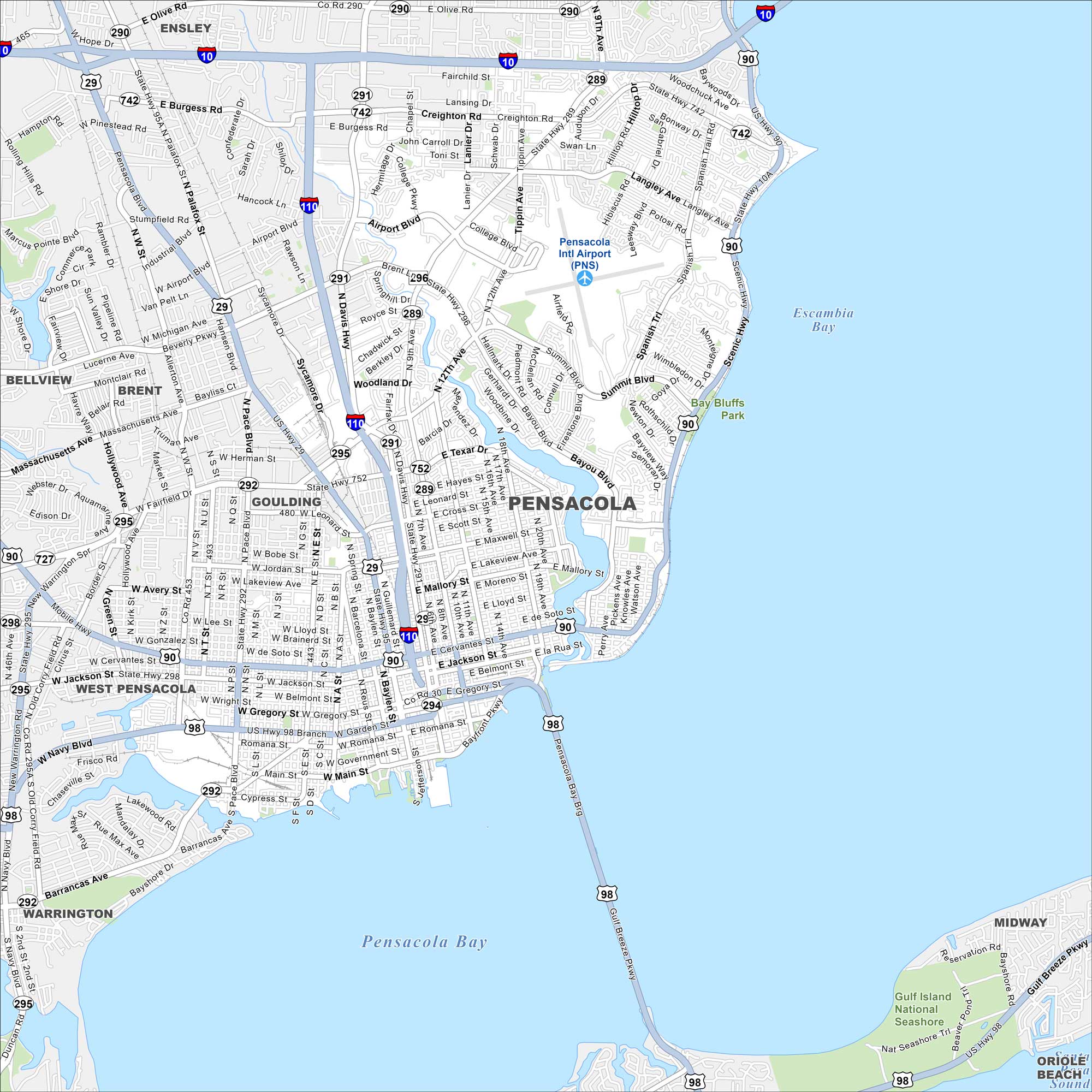
Pensacola lies on the Gulf Coast with white-sand beaches nearby. Our map highlights its downtown area and international airport. The bayfront and barrier islands define its geography.
Florida State Maps
Discover Florida through our state maps


Map Information
On the Map
Interstates/Highways: I-10, US Hwy 90, US Hwy 98, State Rte 10A, State Rte 289, State Rte 29, State Rte 290, State Rte 291, State Rte 292, State Rte 294, State Rte 295, State Rte 296, State Rte 297, State Rte 298, State Rte 727, State Rte 742, State Rte 752 Major Roads: Cervantes St, Garden St, Gregory St, Main St, Palafox St, Davis Hwy, Ninth Ave, Airport Blvd, Creighton Rd, Bayou Blvd, Summit Blvd, Scenic Hwy, Pace Blvd, Navy Blvd, Barrancas Ave, Gulf Breeze Pkwy, Mobile Hwy, Fairfield Dr, Michigan Ave Airports: Pensacola Intl Airport (PNS) Lakes and Reservoirs: Pensacola Bay, Escambia Bay Parks and Preserves: Gulf Island National Seashore, Bay Bluffs Park Nearby Communities: West Pensacola, Warrington, Goulding, Brent, Bellview, Ensley, Midway, Oriole BeachFlorida City Maps
Chart your course through Miami and Florida’s cities


