Map of Pompano Beach, Florida
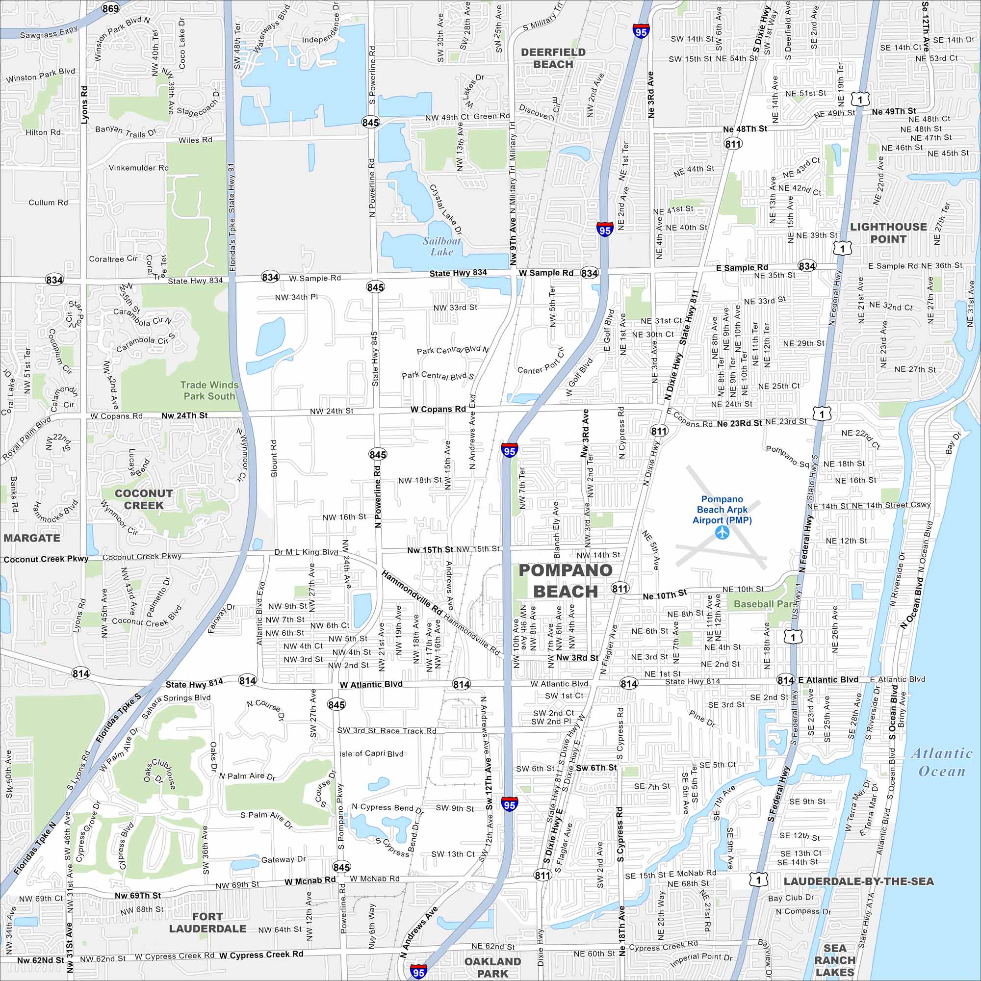
Check out Pompano Beach stretching along the Atlantic shoreline. The map points out beaches, canals, and residential communities. Fishing piers and boating marinas shape the city’s identity.
Florida State Maps
Discover Florida through our state maps


Map Information
On the Map
Interstates/Highways: I-95, US Hwy 1, State Rte 811, State Rte 814, State Rte 834, State Rte 845, Federal Hwy, Dixie Hwy Major Roads: Atlantic Blvd, Sample Rd, Copans Rd, McNab Rd, Powerline Rd, Andrews Ave, Cypress Rd, 3rd Ave, 31st Ave, Coconut Creek Pkwy, Hammondville Rd, ML King Blvd, Ocean Blvd, Riverside Dr, 5th Ave, 15th St, 10th St, 14th St Airports: Pompano Beach Airpark (PMP) Lakes and Reservoirs: Atlantic Ocean, Sailboat Lake, Crystal Lake Parks and Preserves: Trade Winds Park South Nearby Communities: Deerfield Beach, Lighthouse Point, Lauderdale-By-The-Sea, Sea Ranch Lakes, Oakland Park, Fort Lauderdale, Margate, Coconut CreekFlorida City Maps
Chart your course through Miami and Florida’s cities


