Map of Pontiac, Michigan
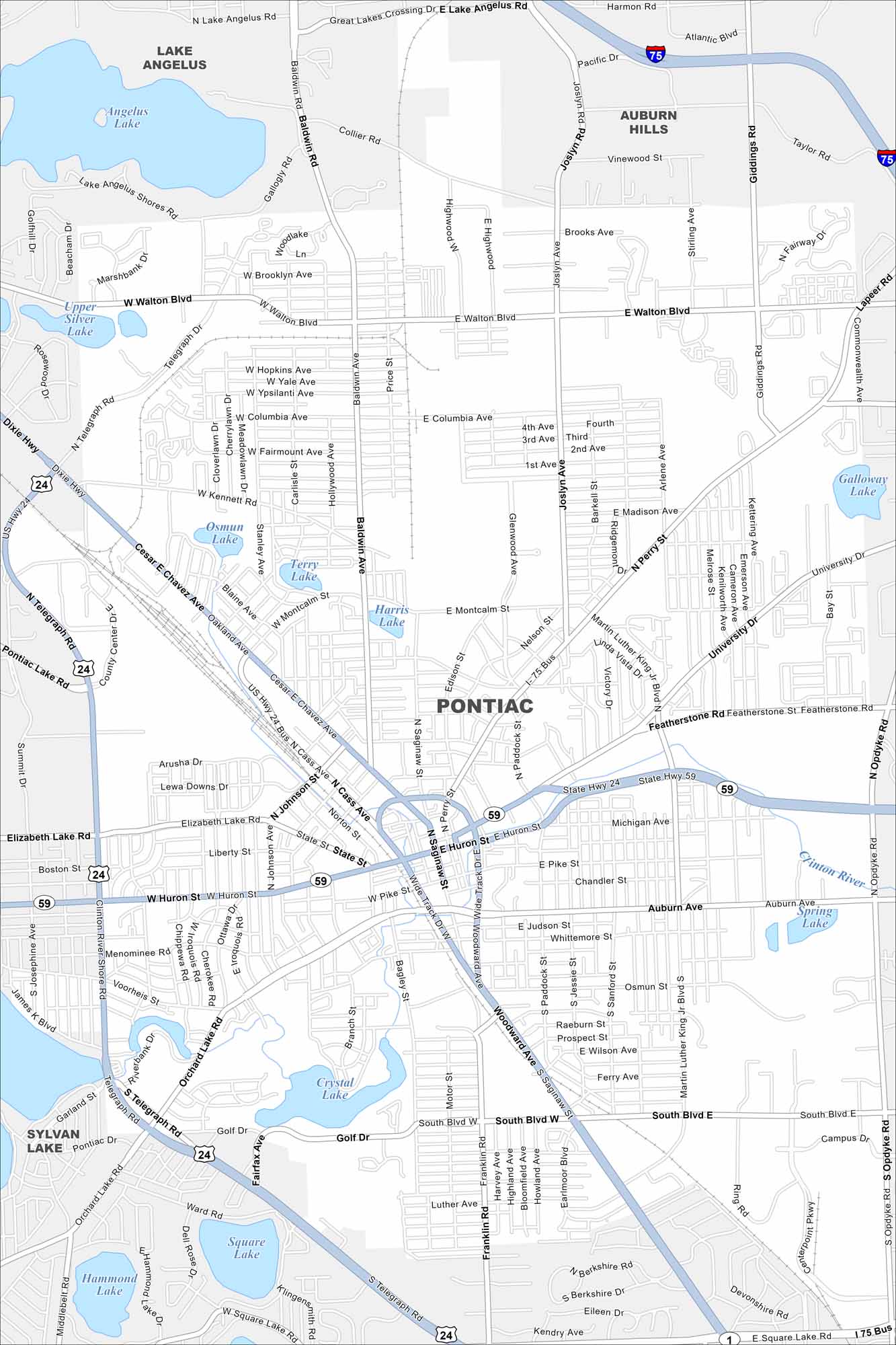
Pontiac sits north of Detroit with a mix of historic and industrial areas. Our map shows its downtown core and highway loops. The city is tied closely to Michigan’s auto industry history.
Map Information
On the Map
Interstates/Highways: I-75, US Hwy 24, State Hwy 59 Major Roads: Woodward Ave, Huron St, Saginaw St, Cesar E Chavez Ave, Telegraph Rd, Walton Blvd, Columbia Ave, Montcalm St, University Dr, Featherstone Rd, Auburn Ave, South Blvd, Elizabeth Lake Rd, Johnson Ave, Pike St, Perry St, Joslyn Ave, Baldwin Ave, Opdyke Rd, Giddings Rd Lakes and Reservoirs: Angelus Lake, Upper Silver Lake, Osmun Lake, Terry Lake, Harris Lake, Crystal Lake, Square Lake, Hammond Lake, Spring Lake Major Rivers: Clinton River Nearby Communities: Lake Angelus, Auburn Hills, Sylvan LakeMichigan State Maps
Get to know Michigan with our detailed maps


City Maps of Michigan
Check out our maps of Detroit and other cities in Michigan


