Map of Port St. Lucie, Florida
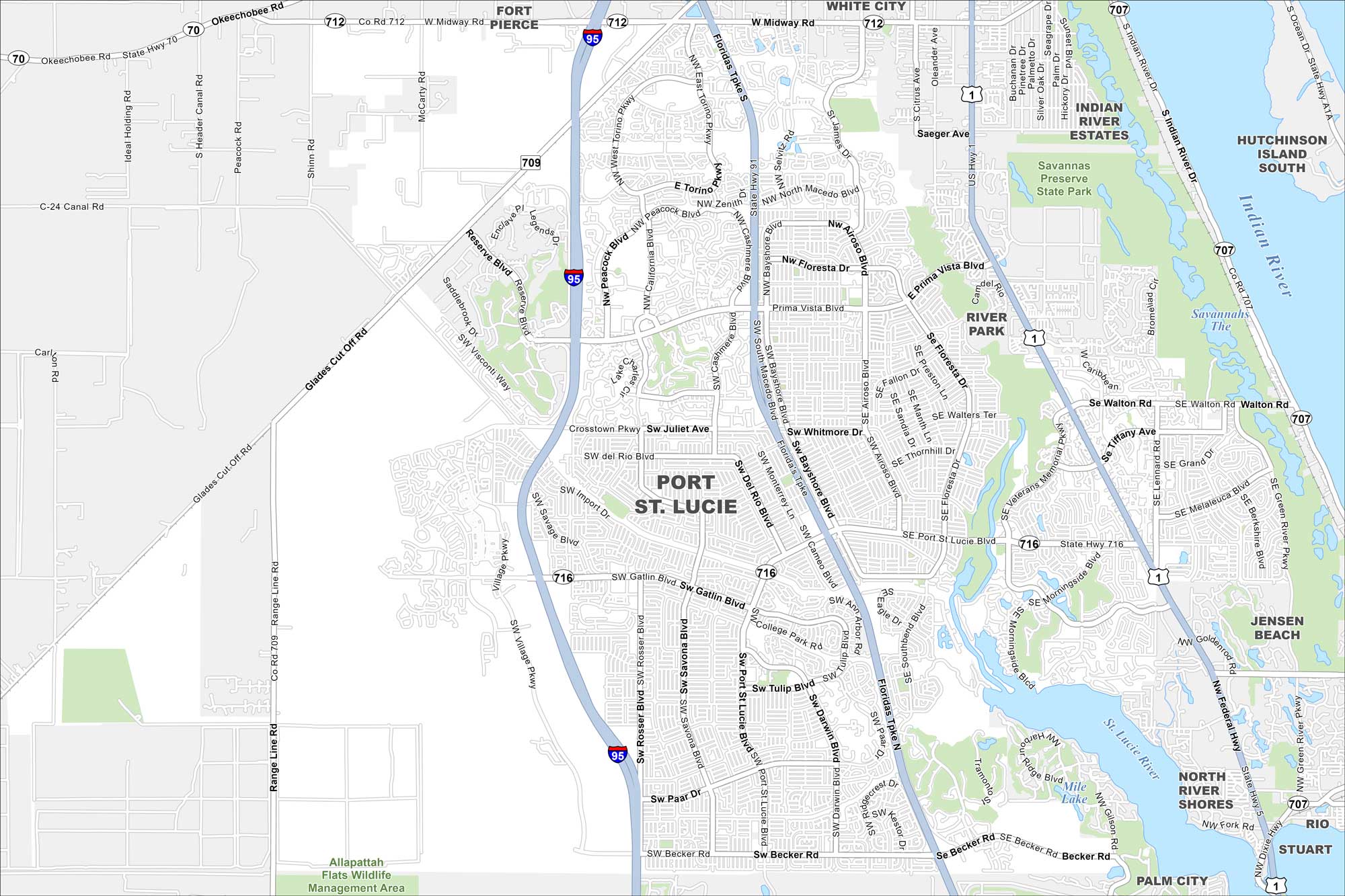
Take a look at Port St. Lucie’s wide suburban layout. Our map shows highways, canals, and the St. Lucie River cutting through town. It’s one of the fastest-growing cities on Florida’s Treasure Coast.
Florida State Maps
Discover Florida through our state maps


Map Information
On the Map
Interstates/Highways: I-95, US Hwy 1, State Rte 716, State Rte 712, State Rte 709, State Rte 707, Federal Hwy Major Roads: Port St. Lucie Blvd, Prima Vista Blvd, Crosstown Pkwy, Gatlin Blvd, Becker Rd, Floresta Dr, Airoso Blvd, Savona Blvd, Bayshore Blvd, Torino Pkwy, California Blvd, Cashmere Blvd, Whitmore Dr, Thornhill Dr, Darwin Blvd, Rosser Blvd, Tulip Blvd, Paar Dr, Macedo Blvd Lakes and Reservoirs: Mile Lake Major Rivers: St. Lucie River, Indian River Parks and Preserves: Allapattah Flats Wildlife Management Area, Savannas Preserve State Park Nearby Communities: Fort Pierce, White City, Indian River Estates, River Park, Jensen Beach, North River Shores, Stuart, Palm City, RioFlorida City Maps
Chart your course through Miami and Florida’s cities


