Map of Portage, Michigan
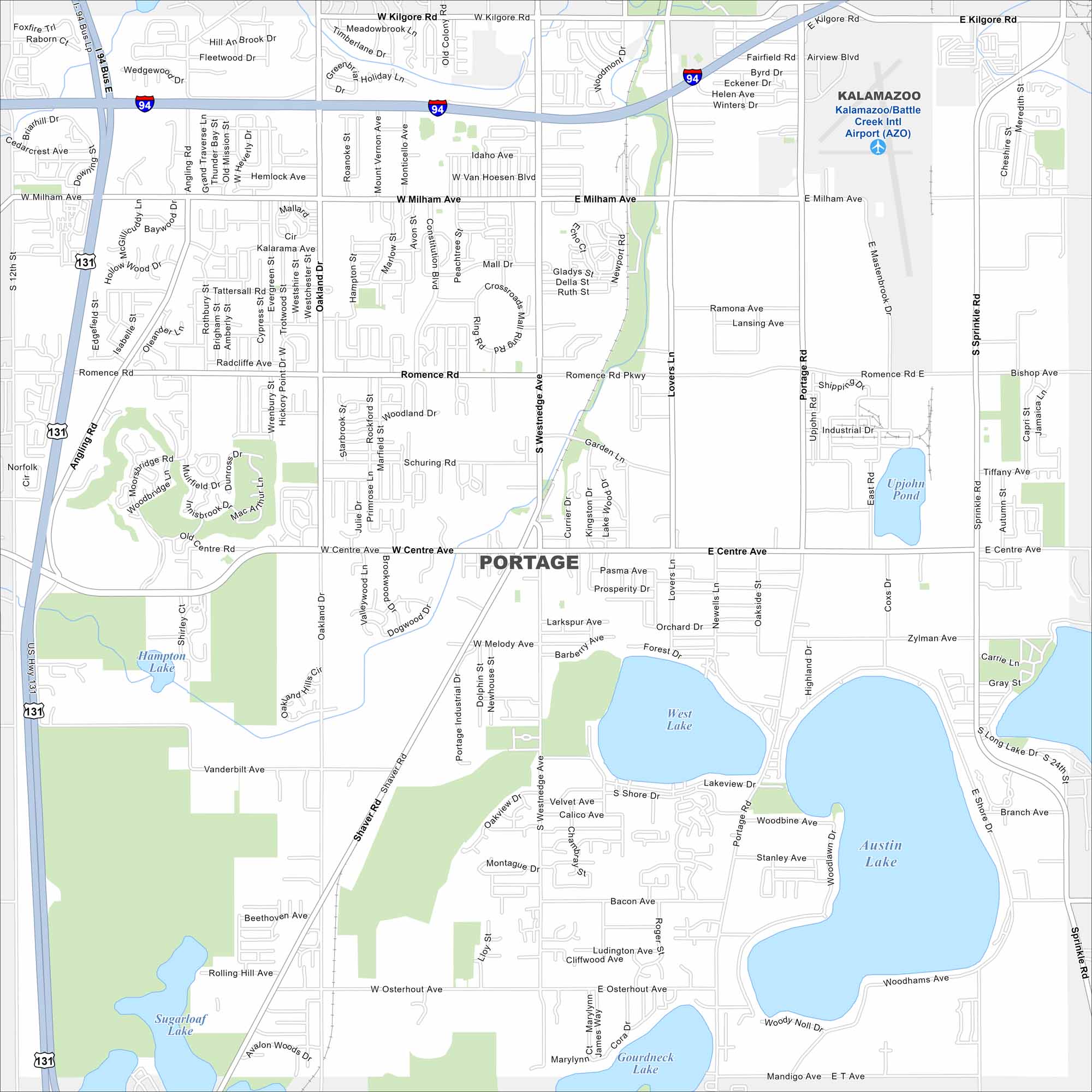
Portage, Michigan sits on gently rolling land. As you can see in our map, there are several small lakes that occupy the region. Major highways connect it to Kalamazoo and nearby parks. It’s also home to several nature trails and recreation areas.
Map Information
On the Map
Interstates/Highways: I-94, US Hwy 131 Major Roads: Westnedge Ave, Centre Ave, Milham Ave, Shaver Rd, Oakland Dr, Portage Rd, Kilgore Rd, Sprinkle Rd, Romence Rd, Angling Rd, Lovers Ln, Osterhout Ave, Mall Dr, Constitution Blvd, Zylman Ave, 12th St, Milham Ave, Meredith St, Bishop Ave, Industrial Dr Airports: Kalamazoo/Battle Creek Intl Airport (AZO) Lakes and Reservoirs: Austin Lake, West Lake, Hampton Lake, Sugarloaf Lake, Gourdneck Lake, Upjohn Pond Nearby Communities: KalamazooMichigan State Maps
Get to know Michigan with our detailed maps


City Maps of Michigan
Check out our maps of Detroit and other cities in Michigan


