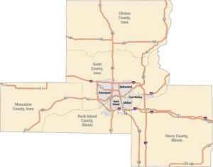
Chicagoland Map
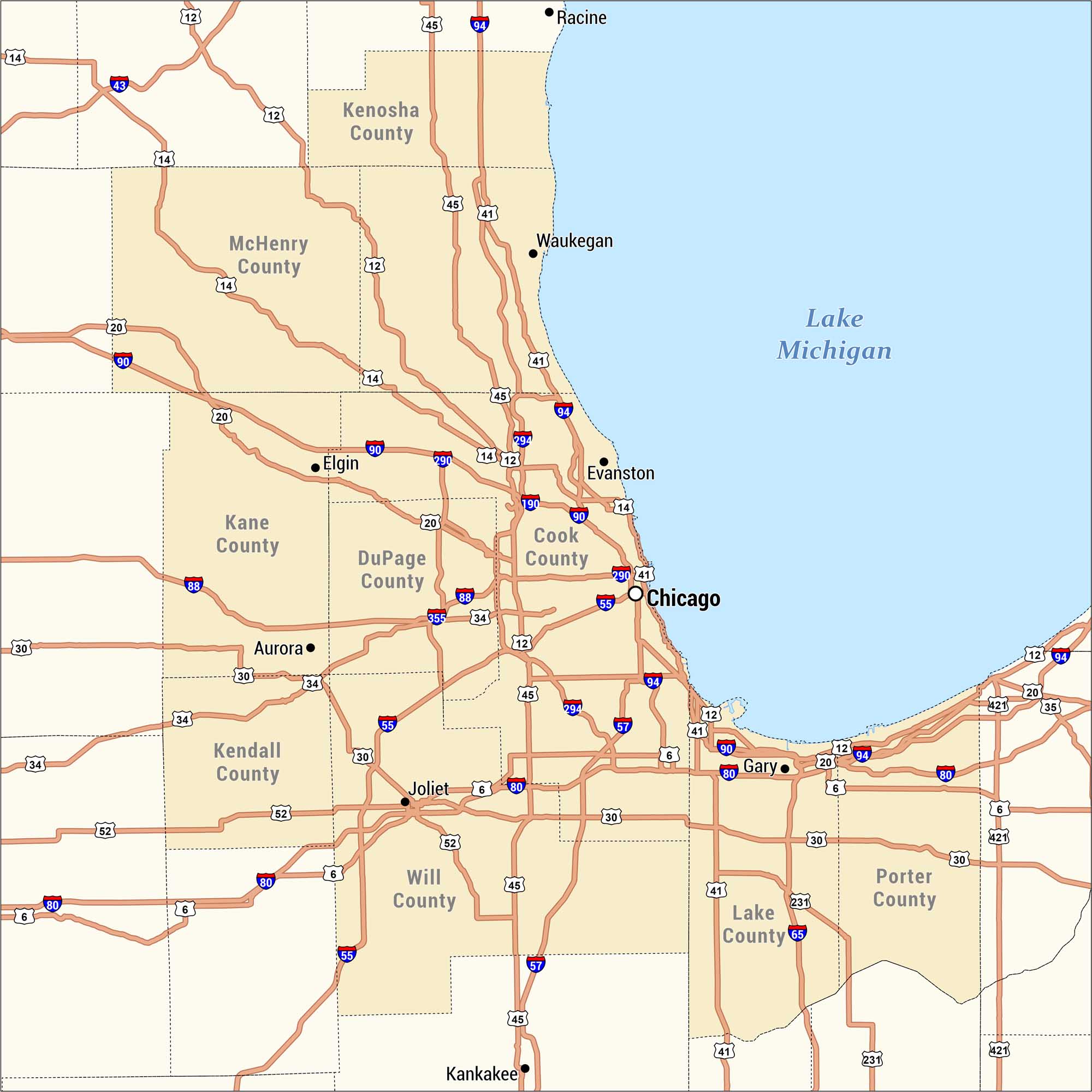
This is a detailed highway and county map of the Chicagoland region. Our map is centered on Chicago along the southwestern shore of Lake Michigan. The map spans Illinois counties to the west and south, and Indiana counties to the southeast, with Wisconsin’s Racine visible at the top.
Map Information
On the Map
Illinois Counties: Cook County, DuPage County, Kane County, McHenry County, Kenosha County, Kendall County, Will County Indiana Counties: Lake County, Porter County Major Cities: Chicago, Evanston, Waukegan, Elgin, Aurora, Joliet, Gary, Racine, Kankakee Highways: I-80, I-88, I-90, I-94, I-190, I-290, I-294, I-355, US-6, US-12, US-14, US-20, US-30, US-34, US-41, US-45, US-52, US-57, US-65, US-231, US-421 Bodies of Water: Lake MichiganMetropolitan Regions
Developed areas, suburban zones, and metro regions.