Map of Rochester, New York
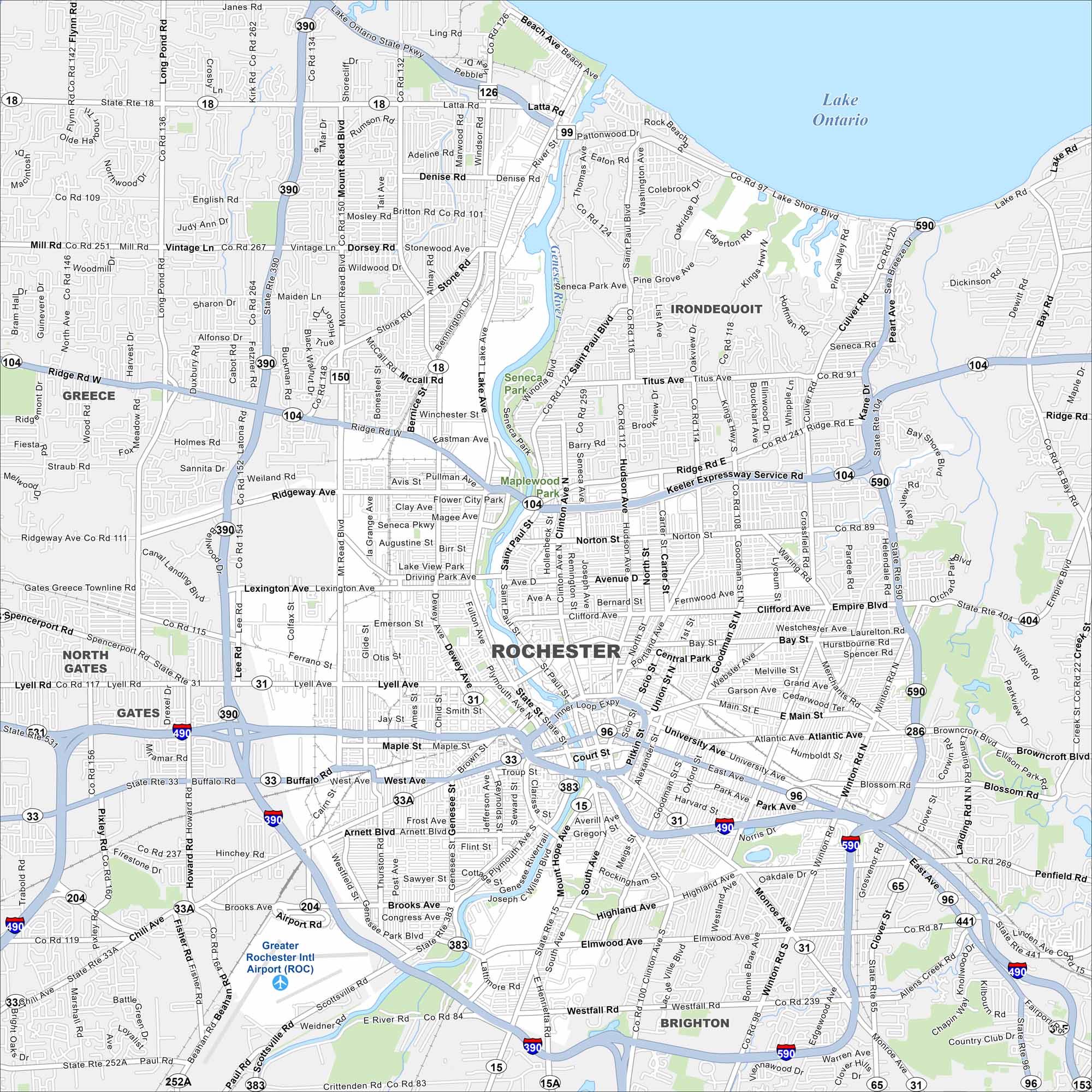
This street map of Rochester lays out the Genesee River and the streets running off it. You’ll also see the highways that circle the city and lead to Lake Ontario in the north.
Map Information
On the Map
Interstates/Highways: I-390, I-490, I-590, State Rte 104, State Rte 18, State Rte 31, State Rte 33, State Rte 33A, State Rte 383, State Rte 15, State Rte 15A, State Rte 96, State Rte 441, State Rte 65 Major Roads: Ridge Rd, Lake Ave, Main St, Mt Read Blvd, Lyell Ave, Culver Rd, Dewey Ave, Clinton Ave, Genesee St, West Ave, Buffalo Rd, Goodman St, Monroe Ave, Winton Rd, Portland Ave, Hudson Ave, Norton St, St Paul St, East Ave, Titus Ave Airports: Greater Rochester Intl Airport (ROC) Lakes and Reservoirs: Lake Ontario Major Rivers: Genesee River Parks and Preserves: Seneca Park, Maplewood Park Nearby Communities: Greece, Irondequoit, Gates, BrightonNew York State Maps
Find state maps of the Empire State.


City Maps of New York
Here are the city maps that define New York


