Florida Panhandle Map
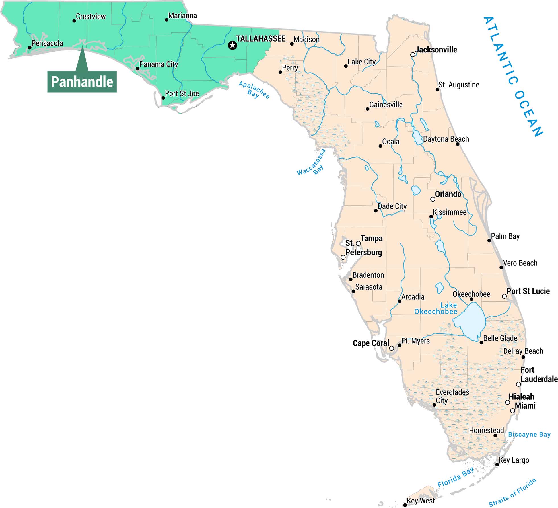
As you can see, our map displays the Panhandle region in the northwestern portion of Florida. We’ve included cities, waterways, and bays.
Map Information
On the Map
Panhandle Cities: Pensacola, Crestview, Marianna, Panama City, Port St. Joe, Tallahassee Other Florida Cities: Jacksonville, St. Augustine, Daytona Beach, Orlando, Kissimmee, Palm Bay, Gainesville, Ocala, Lake City, Madison, Perry, Dade City, Tampa, St. Petersburg, Bradenton, Sarasota, Arcadia, Ft. Myers, Cape Coral, Vero Beach, Port St. Lucie, Okeechobee, Belle Glade, Delray Beach, Fort Lauderdale, Hialeah, Miami, Everglades City, Homestead, Key Largo, Key West Waterways: Atlantic Ocean, Apalachee Bay, Waccasassa Bay, Lake Okeechobee, Biscayne Bay, Florida Bay, Straits of FloridaReferences
Metropolitan Regions
Developed areas, suburban zones, and metro regions.