Inland Empire Map
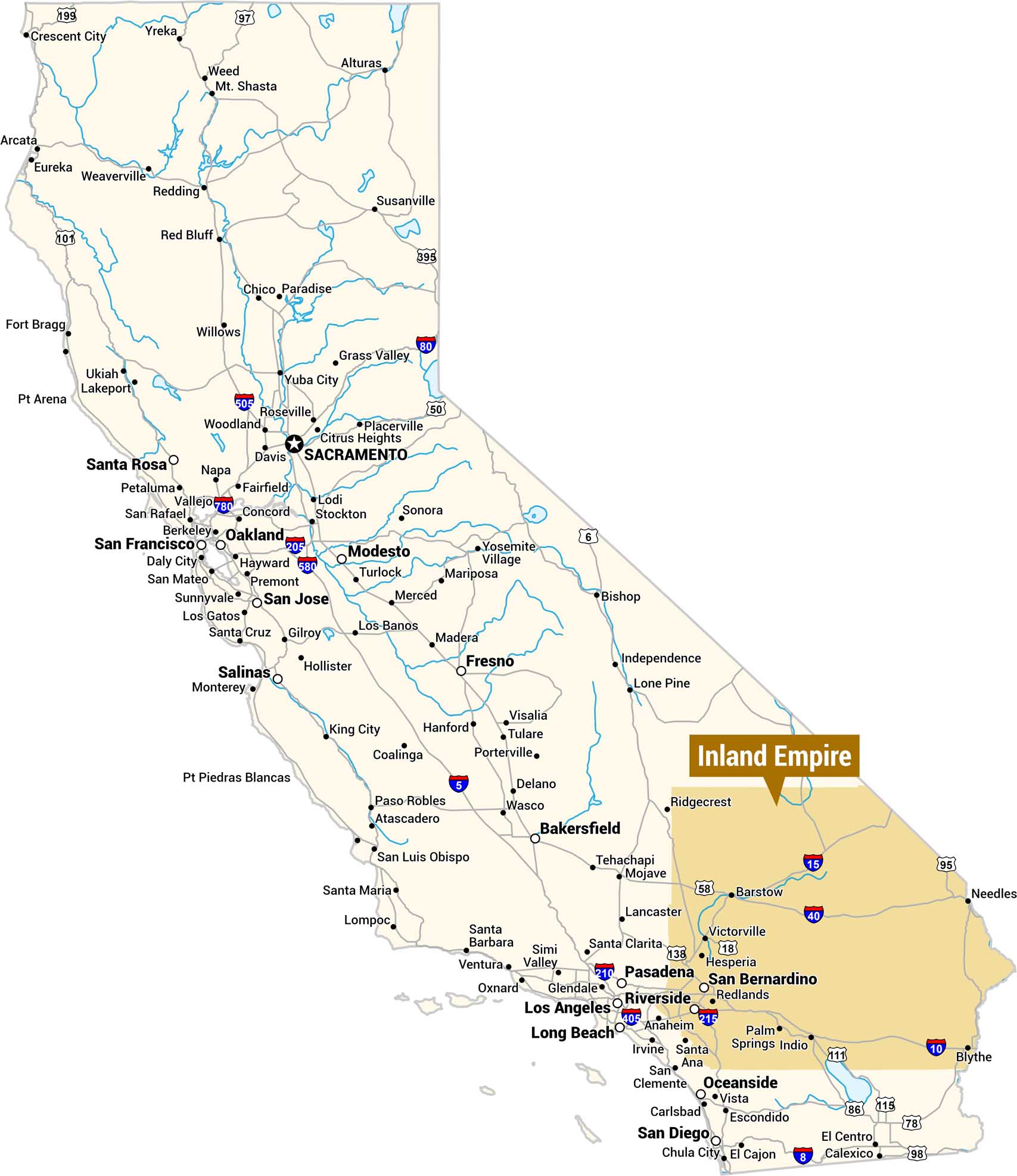
This is a reference map of California highlighting the Inland Empire in orange, located in the southwestern corner of the state east of Los Angeles. The map provides full statewide context with major cities, highways, and rivers.
Map Information
On the Map
Cities Within or Adjacent to the Inland Empire: San Bernardino, Riverside, Redlands, Palm Springs, Indio, Victorville, Hesperia, Barstow, Blythe Highways within the Inland Empire: I-10, I-15, I-40, US-95, US-111, CA-18, CA-58, CA-86, CA-115 Other Major California Cities: Sacramento, San Francisco, Oakland, San Jose, Los Angeles, Long Beach, San Diego, Fresno, Bakersfield, Santa Barbara, Pasadena, Glendale, Santa Rosa, Salinas, Monterey, Modesto, Stockton, Anaheim, Irvine, Santa Ana, Oxnard, Ventura, Lancaster, Santa Clarita, Ridgecrest, Bishop, Lone Pine, Needles Statewide Highways: I-5, I-80, I-505, I-580, I-780, I-205, I-210, I-405, I-215, US-50, US-97, US-101, US-395, US-6, CA-99, CA-138Metropolitan Regions
Developed areas, suburban zones, and metro regions.