Lowcountry Map, South Carolina
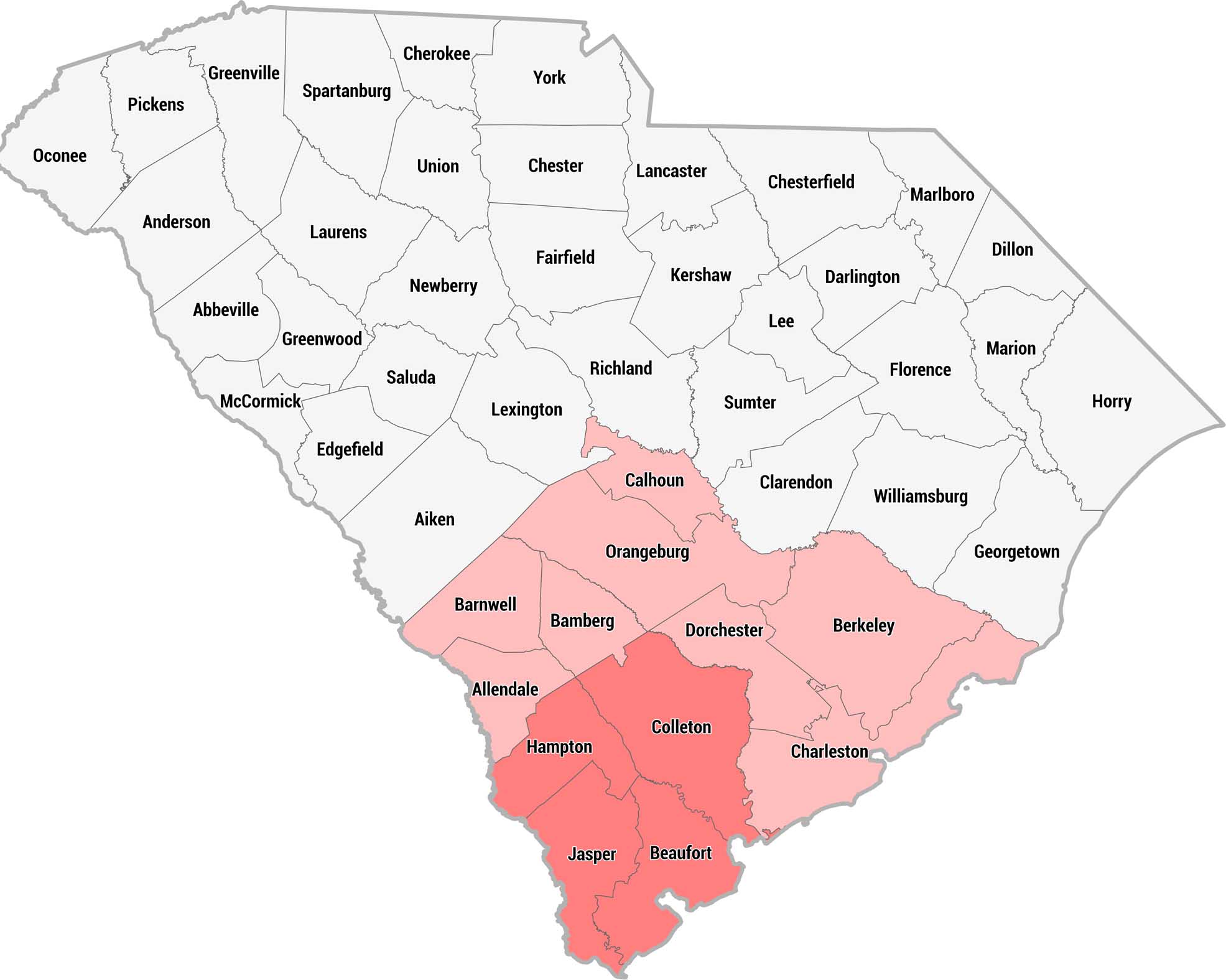
This county map of South Carolina highlights the Lowcountry region in pink and red across the southern and coastal portions of the state. Darker shading indicates the core Lowcountry counties, while lighter pink shows the broader surrounding region.
Map Information
On the Map
Core Lowcountry Counties (darker red): Hampton, Jasper, Beaufort, Colleton Broader Lowcountry Counties (pink): Allendale, Barnwell, Bamberg, Orangeburg, Calhoun, Dorchester, Berkeley, Charleston Other South Carolina Counties: Oconee, Pickens, Greenville, Spartanburg, Cherokee, York, Anderson, Laurens, Union, Chester, Lancaster, Chesterfield, Marlboro, Abbeville, Greenwood, Newberry, Fairfield, Kershaw, Darlington, Dillon, McCormick, Saluda, Lexington, Richland, Sumter, Lee, Florence, Marion, Horry, Edgefield, Aiken, Clarendon, Williamsburg, GeorgetownReferences
Metropolitan Regions
Developed areas, suburban zones, and metro regions.