Midwest US Map
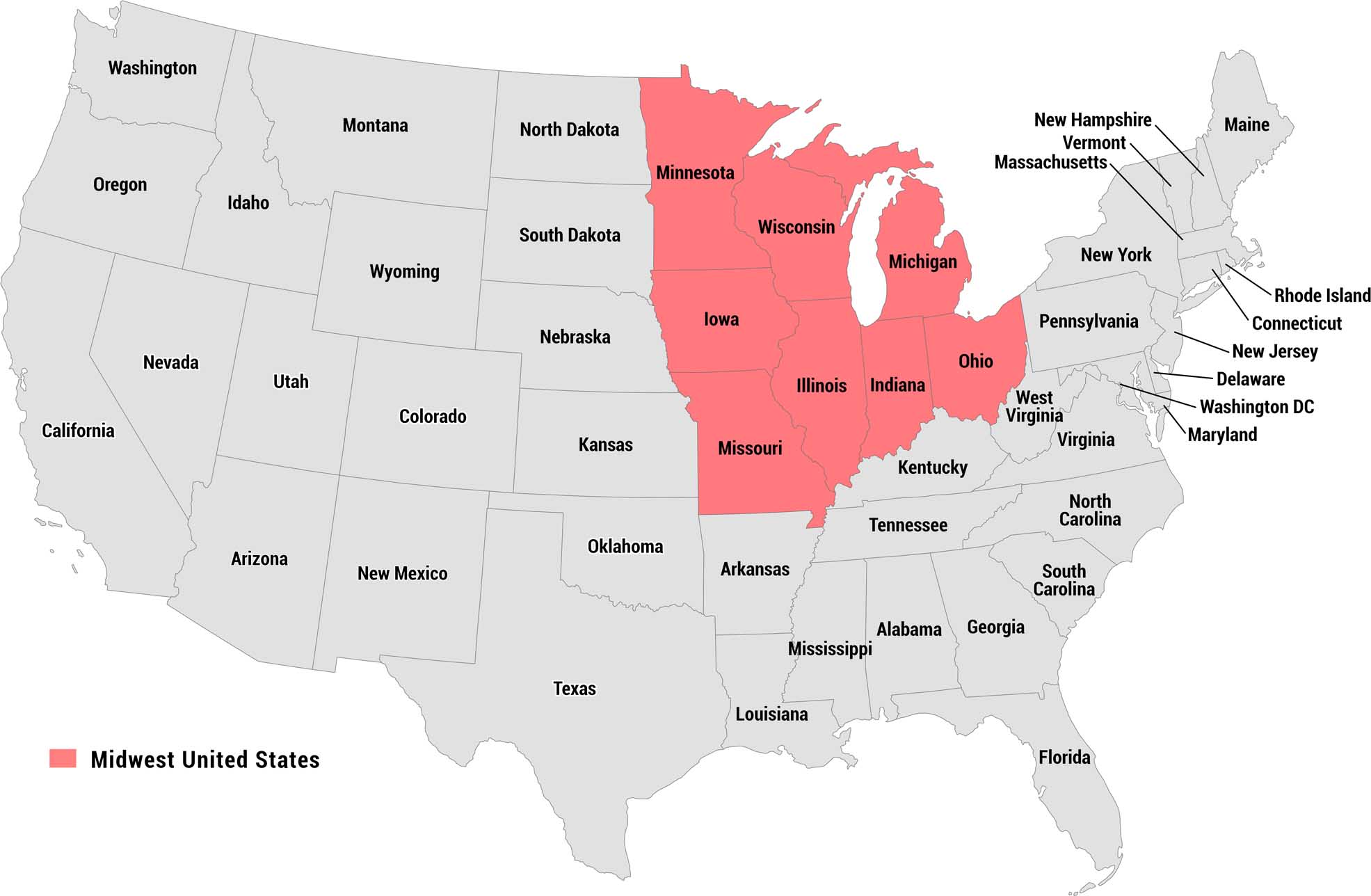
Our reference map highlights the Midwest United States in red/pink, clearly distinguishing the region from the remaining states shown in gray. A legend in the lower left identifies the highlighted region.
Map Information
On the Map
Midwest US: Minnesota, Wisconsin, Michigan, Iowa, Illinois, Indiana, Ohio, Missouri All Other States Shown: Washington, Oregon, California, Nevada, Idaho, Montana, Wyoming, Utah, Colorado, Arizona, New Mexico, North Dakota, South Dakota, Nebraska, Kansas, Oklahoma, Texas, Arkansas, Louisiana, Mississippi, Alabama, Georgia, Florida, Tennessee, Kentucky, West Virginia, Virginia, North Carolina, South Carolina, Pennsylvania, New York, Maine, New Hampshire, Vermont, Massachusetts, Rhode Island, Connecticut, New Jersey, Delaware, Maryland, Washington DCMetropolitan Regions
Developed areas, suburban zones, and metro regions.