Missouri Bootheel Map
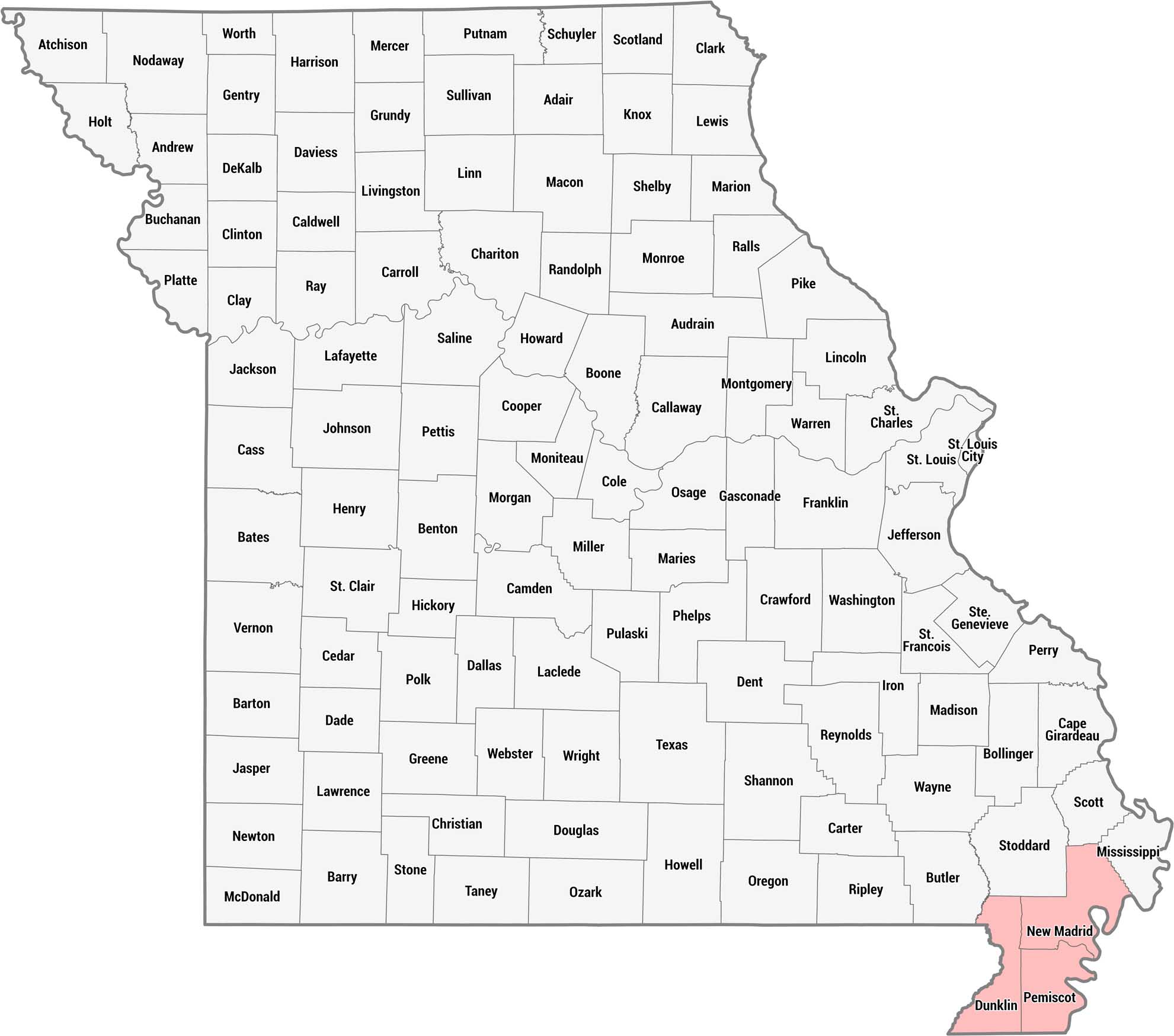
We created this county map of Missouri to highlight the Bootheel region in pink. This distinctive geographic appendage sits juts southward into the surrounding states of Arkansas and Tennessee. All 114 counties are labeled across the state.
Map Information
References
Metropolitan Regions
Developed areas, suburban zones, and metro regions.