New York Regions Map
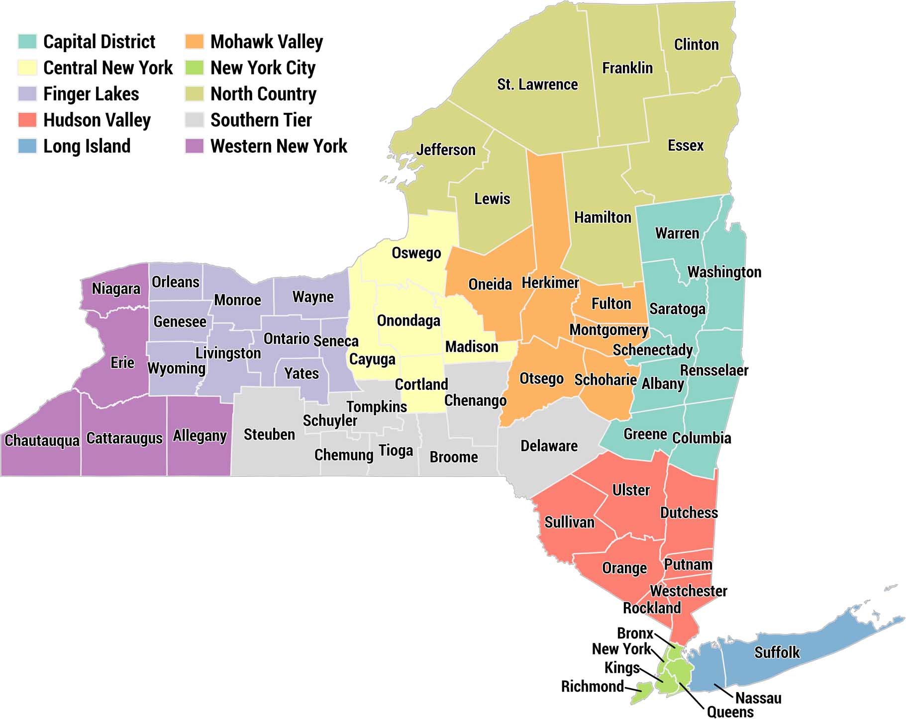
This is a color-coded county map of New York State divided into its 10 official regions. Each region has a distinct color with a legend in the upper left. We’ve labeled all 62 counties in the state of New York.
Map Information
On the Map
Capital District (teal): Warren, Washington, Saratoga, Schenectady, Albany, Rensselaer, Greene, Columbia Central New York (yellow): Oswego, Onondaga, Cayuga, Cortland, Madison Finger Lakes (lavender): Orleans, Monroe, Wayne, Ontario, Seneca, Yates, Livingston, Wyoming, Genesee, Schuyler, Tompkins Hudson Valley (salmon): Sullivan, Ulster, Dutchess, Orange, Putnam, Rockland, Westchester Long Island (blue): Nassau, Suffolk Mohawk Valley (orange): Jefferson, Lewis, Oneida, Herkimer, Fulton, Montgomery, Otsego, Schoharie, Chenango New York City (bright green): Bronx, New York, Kings, Richmond, Queens North Country (olive/yellow-green): St. Lawrence, Franklin, Clinton, Essex, Hamilton Southern Tier (gray): Steuben, Allegany, Chemung, Tioga, Broome, Delaware, Schuyler Western New York (purple): Chautauqua, Cattaraugus, Erie, NiagaraMetropolitan Regions
Developed areas, suburban zones, and metro regions.


Hi John. Thanks for the comment. They are as follows:
1. Capital District
2. Central New York
3. Finger Lakes
4. Hudson Valley
5. Long Island
6. Mohawk Valley
7. New York City
8. North Country
9. Southern Tier
10. Western New York
WHAT ARE THE REGIONS OF THE STATE NEW YORK