Map of Sarasota, Florida
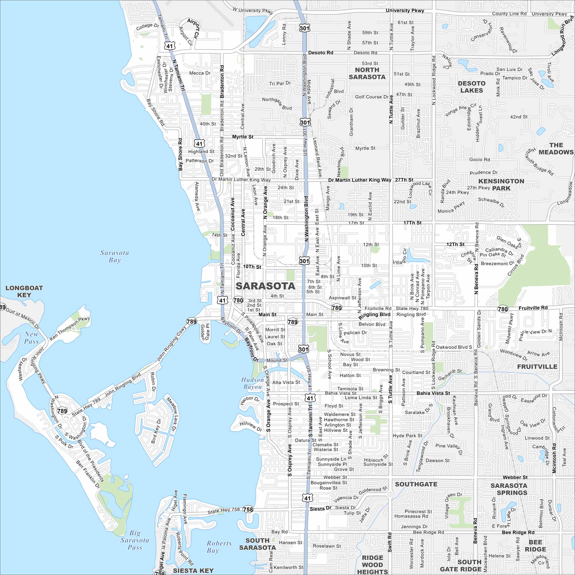
Our map of Sarasota, Florida points out its beaches and waterfront along Sarasota Bay. It’s a city full of culture and coastal beauty.
Florida State Maps
Discover Florida through our state maps


Map Information
On the Map
Interstates/Highways: US Hwy 301, US Hwy 41, State Rte 780, State Rte 789, State Rte 758 Major Roads: Main St, Washington Blvd, Tamiami Trl, Fruitville Rd, Ringling Blvd, University Pkwy, Bee Ridge Rd, Bahia Vista St, Tuttle Ave, Beneva Rd, Siesta Dr, Lockwood Ridge Rd, Osprey Ave, Orange Ave, Shade Ave, Lime Ave, Webber St, Martin Luther King Way, Myrtle St, Proctor Rd Lakes and Reservoirs: Sarasota Bay, Roberts Bay, Hudson Bayou Nearby Communities: North Sarasota, Desoto Lakes, The Meadows, Kensington Park, Sarasota Springs, Bee Ridge, Southgate, Ridge Wood Heights, Siesta Key, Longboat KeyFlorida City Maps
Chart your course through Miami and Florida’s cities


