Map of Saratoga Springs, New York
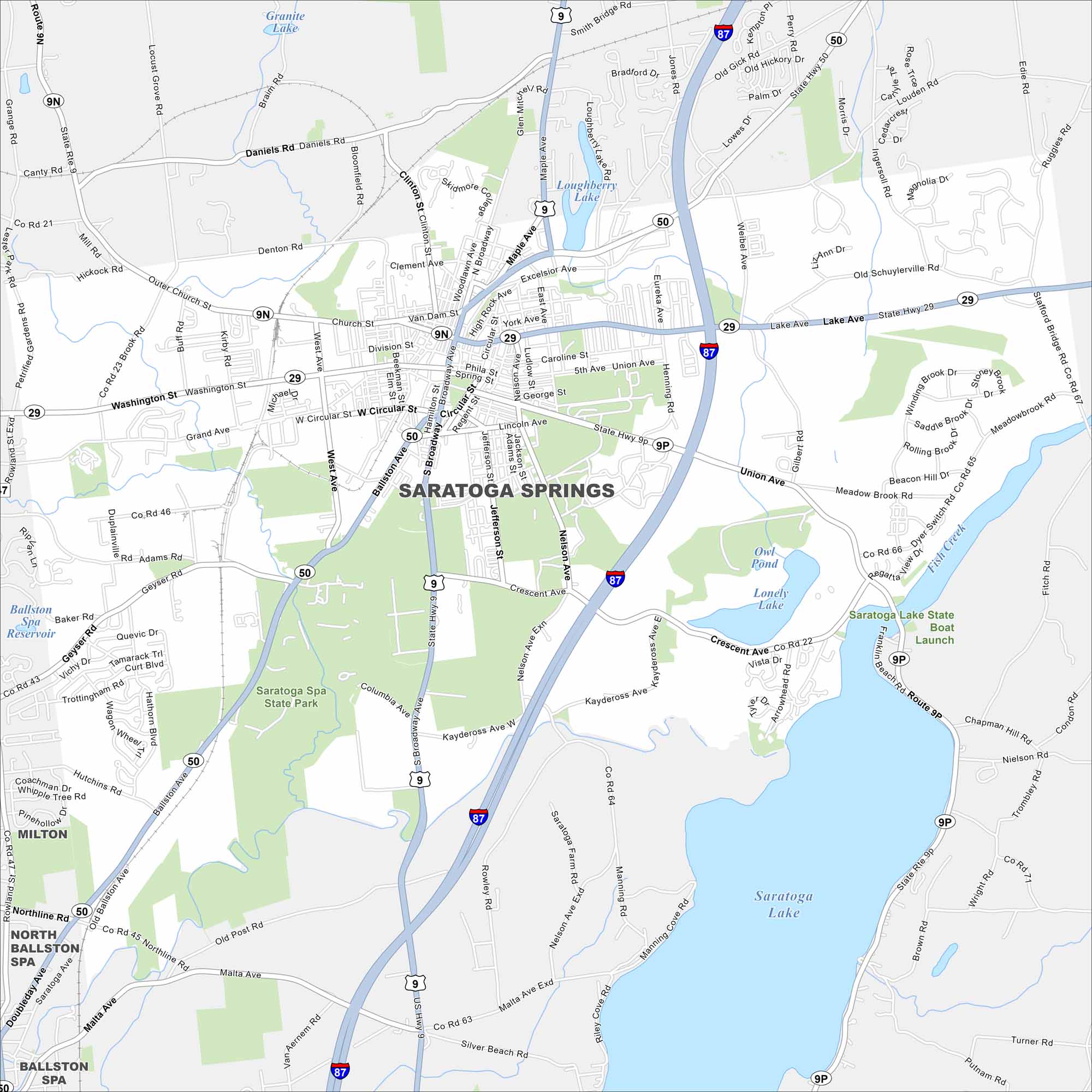
Our map of Saratoga Springs shows the highways and roads that make up this city in New York. You’ll also find the massive Saratoga Lake and Fish Creek on the east side.
Map Information
On the Map
Interstates/Highways: I-87, State Rte 29, State Rte 50, State Rte 9, State Rte 9N, State Rte 9P Major Roads: Broadway, Union Ave, Lake Ave, Ballston Ave, Church St, Washington St, West Ave, Nelson Ave, Crescent Ave, South Broadway, Circular St, Daniels Rd, Grand Ave, Geyser Rd, Malta Ave, Henning Rd, Louden Rd, Gilbert Rd, Meadow Brook Rd, Kaydeross Ave Lakes and Reservoirs: Saratoga Lake, Loughberry Lake, Granite Lake, Owl Pond, Lonely Lake Parks and Preserves: Saratoga Spa State Park Nearby Communities: Milton, North Ballston Spa, Ballston Spa, MaltaNew York State Maps
Find state maps of the Empire State.


City Maps of New York
Here are the city maps that define New York


