Map of Schenectady, New York
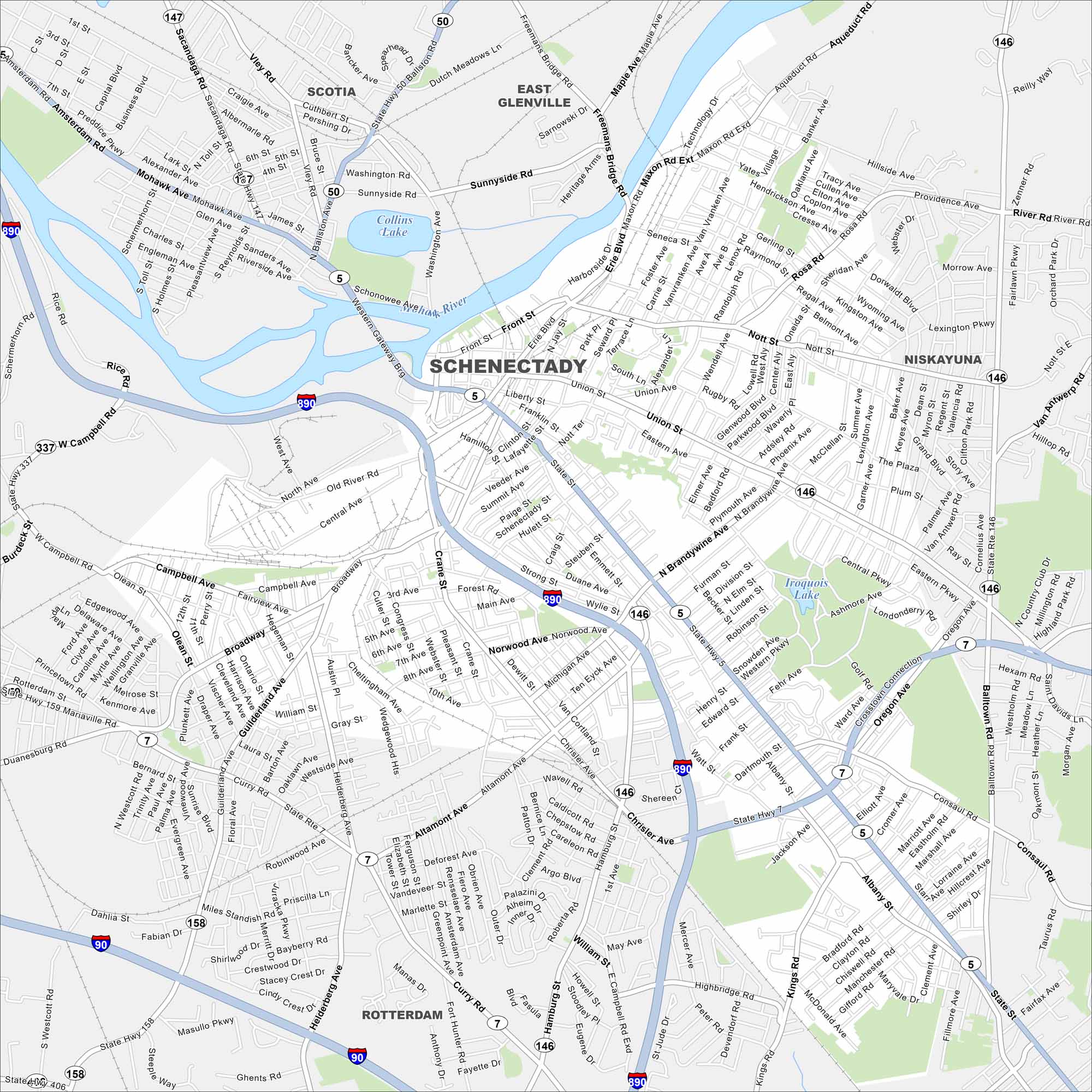
Our map of Schenectady highlights its historic Stockade District, General Electric roots, and ties to the Mohawk River. It’s a city with deep history and character.
Map Information
On the Map
Interstates/Highways: I-890, State Rte 5, State Rte 7, State Rte 146, State Rte 147, State Rte 158 Major Roads: State St, Erie Blvd, Broadway, Union St, Nott St, Balltown Rd, Altamont Ave, Campbell Ave, Guilderland Ave, Consaul Rd, Rosa Rd, Van Vranken Ave, Curry Rd, Helderberg Ave, Michigan Ave, Chrisler Ave, Albany St, Brandywine Ave, Freeman Bridge Rd, Maxon Rd Lakes and Reservoirs: Collins Lake, Iroquois Lake Major Rivers: Mohawk River Nearby Communities: Scotia, East Glenville, Niskayuna, RotterdamNew York State Maps
Find state maps of the Empire State.


City Maps of New York
Here are the city maps that define New York


