Map of Seminole, Florida
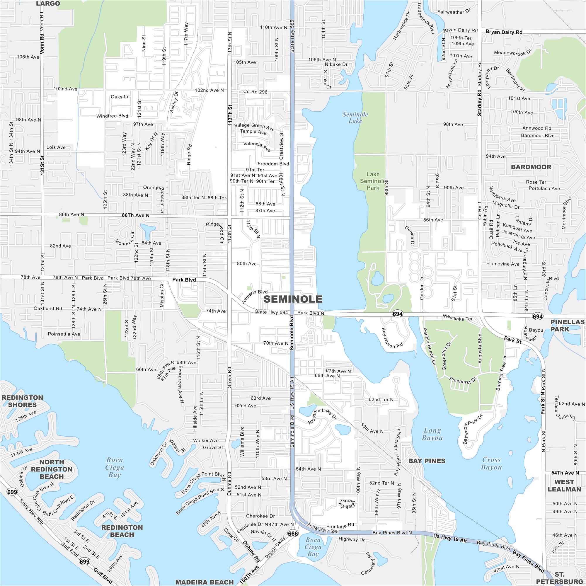
Our map of Seminole shows this Gulf Coast city near Tampa Bay. With nearby beaches and trails, it’s easy to navigate and enjoy.
Florida State Maps
Discover Florida through our state maps


Map Information
On the Map
Interstates/Highways: State Rte 694, State Rte 666, State Rte 699, State Rte 595 Major Roads: Park Blvd, Seminole Blvd, Bay Pines Blvd, Starkey Rd, Bryan Dairy Rd, 113th St, 102nd Ave, 86th Ave, 131st St, Oakhurst Rd, Duhme Rd, 74th Ave, 54th Ave, 94th Ave, 110th Ave, 98th Ave, 117th St, 119th St, 125th St, 102nd Ave N Lakes and Reservoirs: Boca Ciega Bay, Seminole Lake, Long Bayou, Cross Bayou Parks and Preserves: Lake Seminole Park Nearby Communities: Largo, Bardmoor, Pinellas Park, West Lealman, Bay Pines, Madeira Beach, Redington Beach, North Redington Beach, Redington Shores, St. PetersburgFlorida City Maps
Chart your course through Miami and Florida’s cities


