Map of Show Low, Arizona
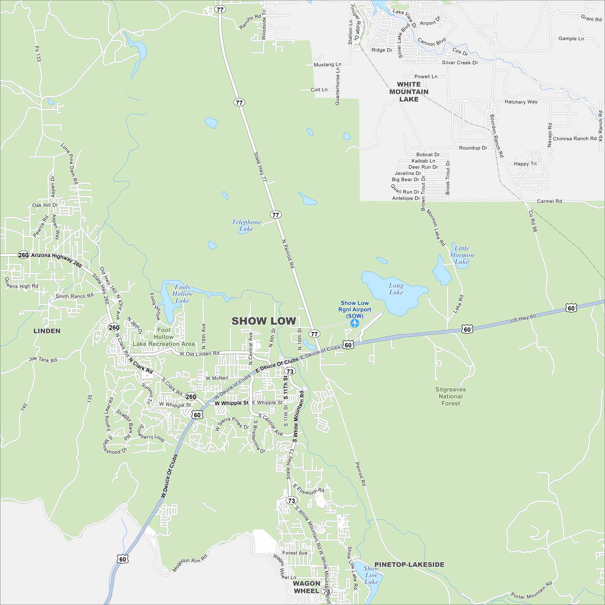
Show Low is a bit of an oddball name. Nevertheless, our map highlights this mountain town. Surrounded by the White Mountains, it’s popular for hiking, fishing, and camping.
Arizona State Maps
Check out our Arizona state maps we’ve put together


Map Information
On the Map
Interstates/Highways: US Hwy 60 (Deuce of Clubs), Arizona Highway 260, State Hwy 77, State Hwy 73 Major Roads: White Mountain Blvd, Whipple St, Clark Rd, Old Linden Rd, Show Low Lake Rd, Penrod Rd, McNeil St, Central Ave, 11th St, 16th St, 16th Ave, 43rd Ave, Lone Pine Dam Rd, Porter Mountain Rd, Bourdon Ranch Rd, Navajo Rd, Co Rd 98, Mills St, Owens High Rd Airports: Show Low Rgnl Airport (SOW) Lakes and Reservoirs: Show Low Lake, Fools Hollow Lake, Telephone Lake, Long Lake, Little Mormon Lake Parks/Preserves/Forests: Sitgreaves National Forest, Fool Hollow Lake Recreation Area Nearby Communities: Pinetop-Lakeside, Linden, Wagon Wheel, White Mountain LakeArizona City Maps
Here’s our full batch of Arizona city maps


