Map of Sierra Vista, Arizona
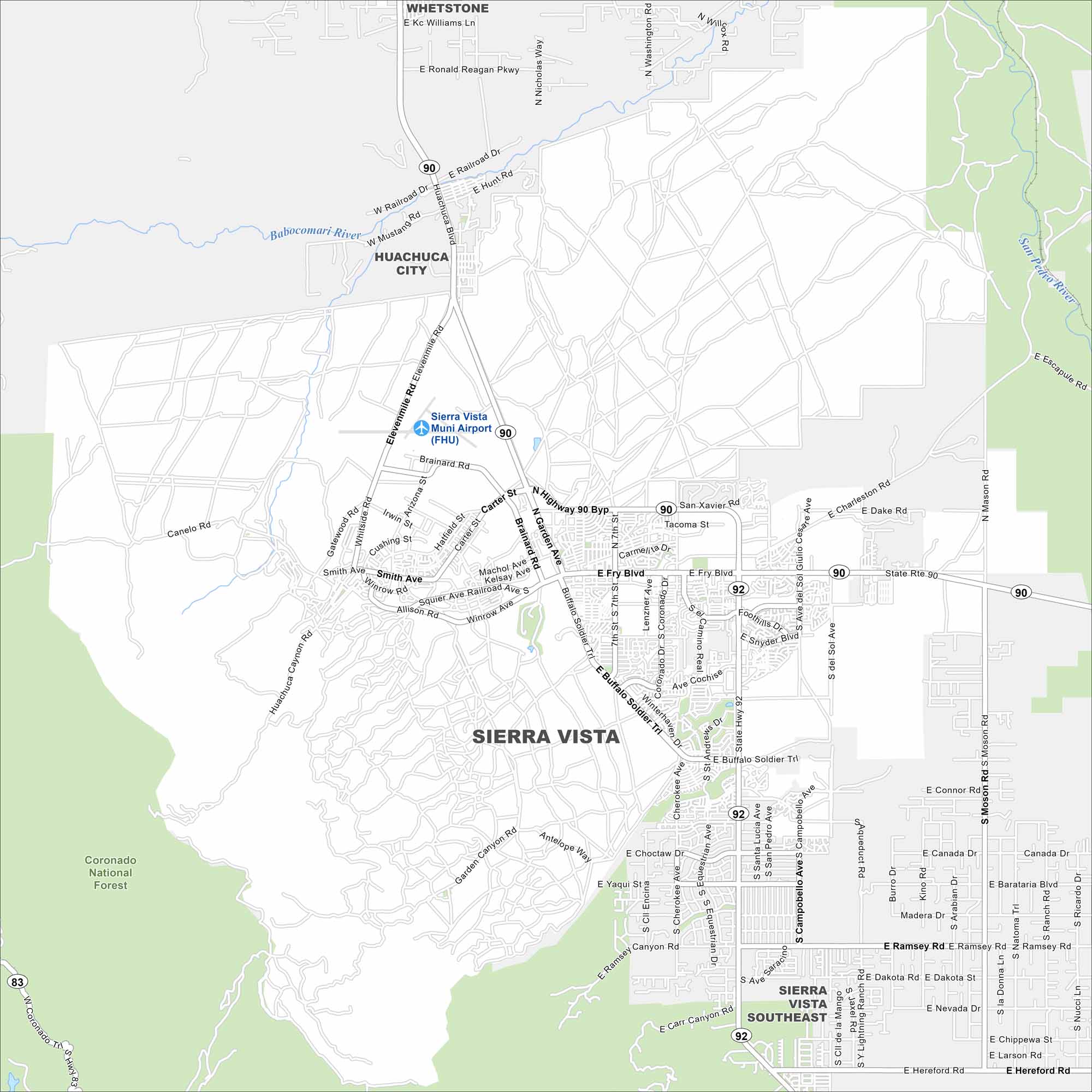
Here’s how to get around Sierra Vista, Arizona with our road and highways map. It’s a gateway to Fort Huachuca, canyons, and desert trails.
Arizona State Maps
Check out our Arizona state maps we’ve put together


Map Information
On the Map
Interstates/Highways: State Rte 90, State Rte 92 Major Roads: Fry Blvd, Buffalo Soldier Trl, Hwy 90 Byp, Coronado Dr, Garden Ave, Ramsey Rd, Hereford Rd, Charleston Rd, Moson Rd, Lenzner Ave, Snyder Blvd, Wilcox Dr, El Camino Real, Colombo Ave, Yaqui St, Choctaw Dr, Avenida del Sol, Foothills Dr, Tacoma St, San Xavier Rd Airports: Sierra Vista Muni Airport (FHU) Rivers and Creeks: Babocomari River, San Pedro River Parks/Preserves/Forests: Coronado National Forest Nearby Communities: Huachuca City, Whetstone, Sierra Vista SoutheastArizona City Maps
Here’s our full batch of Arizona city maps


