Map of Sleepy Hollow, New York
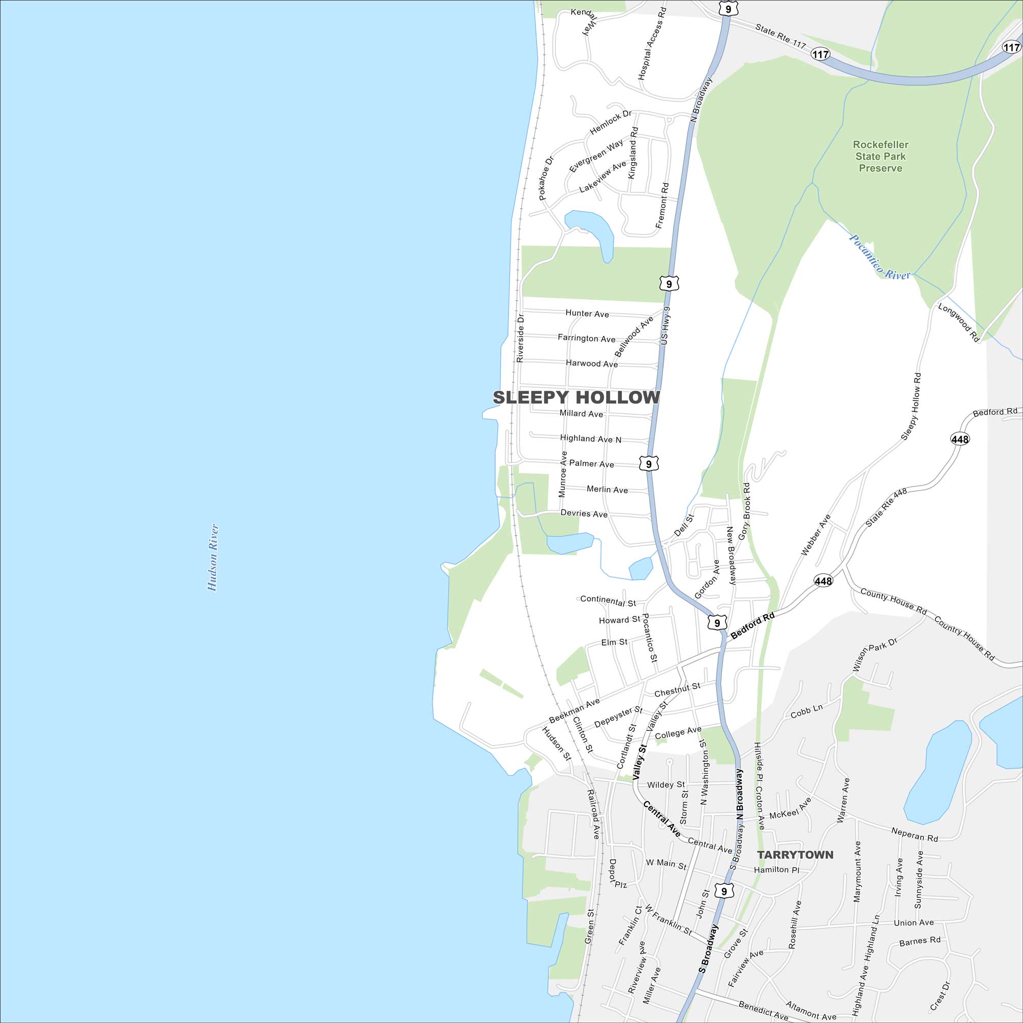
Get oriented with our Sleepy Hollow map in the state of New York. This historic Hudson River village is tied to the famous Legend of Sleepy Hollow.
Map Information
On the Map
Interstates/Highways: US Hwy 9, State Rte 117, State Rte 448 Major Roads: Broadway, Bedford Rd, Beekman Ave, Clinton St, Valley St, Horseman Blvd, Route 9, Sleepy Hollow Rd, Webber Ave, Gory Brook Rd, Continental St, Elm St, Depeyster St, Wildey St, Central Ave, Main St, Franklin St, Sunnyside Ave, Neperan Rd, Benedict Ave Major Rivers: Hudson River, Pocantico River Parks and Preserves: Rockefeller State Park Preserve Nearby Communities: TarrytownNew York State Maps
Find state maps of the Empire State.


City Maps of New York
Here are the city maps that define New York


