Map of Southfield, Michigan
Our Southfield map helps you explore this Detroit-area city. Corporate towers mix with residential neighborhoods and plenty of green spaces.
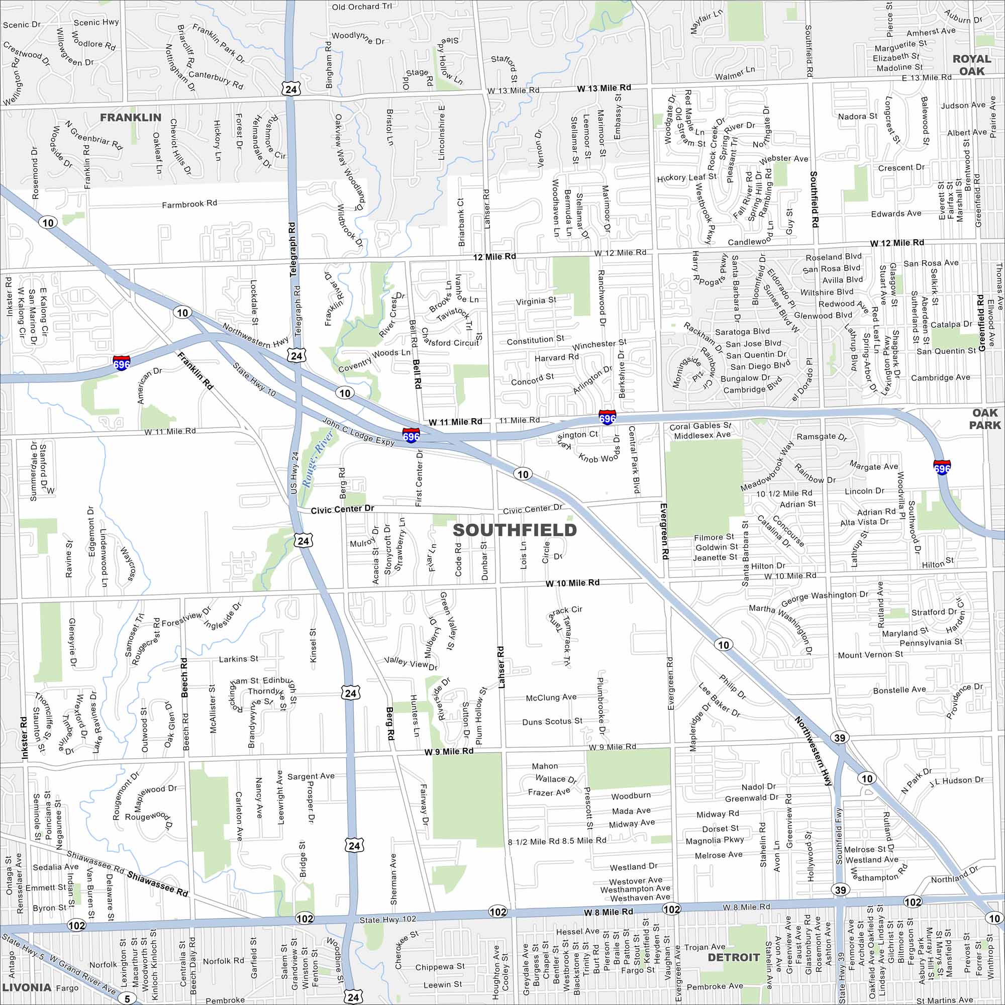
Map Information
On the Map
Interstates/Highways: I-696, US Hwy 24, State Hwy 10, State Hwy 102 Major Roads: Telegraph Rd, 8 Mile Rd, 12 Mile Rd, 10 Mile Rd, 11 Mile Rd, 9 Mile Rd, Northwestern Hwy, Southfield Rd, Evergreen Rd, Lahser Rd, Franklin Rd, Inkster Rd, Beech Rd, Berg Rd, 13 Mile Rd, 8 1/2 Mile Rd Major Rivers: Rouge River Nearby Communities: Franklin, Royal Oak, Oak Park, Southfield, Detroit, LivoniaMichigan State Maps
Get to know Michigan with our detailed maps


City Maps of Michigan
Check out our maps of Detroit and other cities in Michigan


