Map of Spring Lake, North Carolina
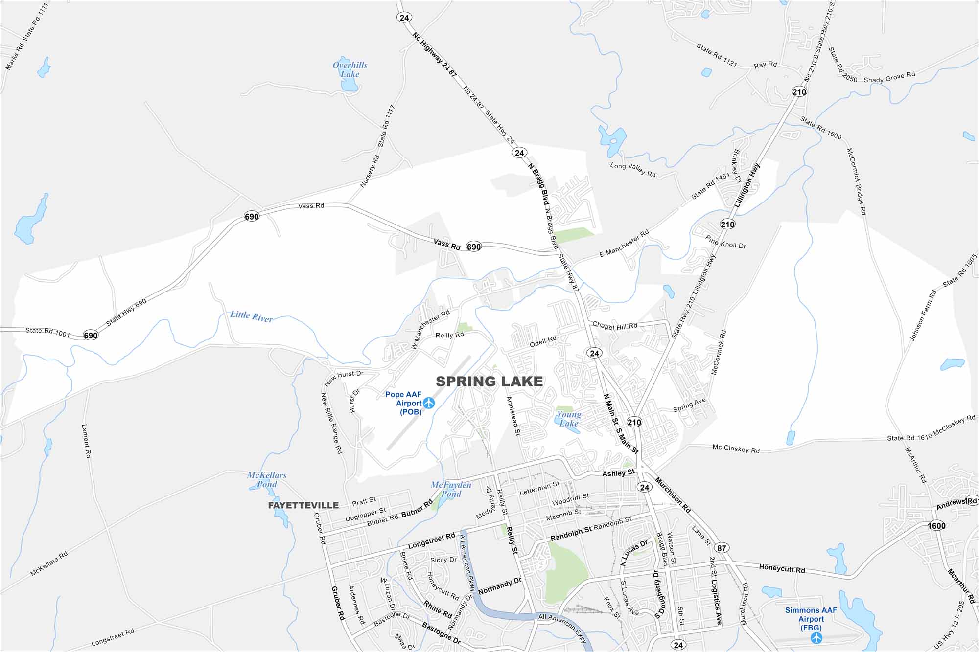
Our map of Spring Lake shows this community next to Fort Liberty. Military ties, local shops, and parks shape everyday life here. You can see Pope Army Airfield on our map of Spring Lake.
Map Information
On the Map
Interstates/Highways: State Rte 24, State Rte 87, State Rte 210, State Rte 690 Major Roads: Bragg Blvd, Main St, Murchison Rd, Vass Rd, Manchester Rd, Lillington Hwy, Chapel Hill Rd, Odell Rd, Nursery Rd, Mc Closkey Rd, Andrews Rd, Macarthur Rd, Honeycutt Rd, Randolph St, Butner Rd, Longstreet Rd, Sicily Dr, Normandy Dr, Reilly St, Letterman St Airports: Pope AAF Airport (POB), Simmons AAF Airport (FBG) Lakes and Reservoirs: Overhills Lake, Young Lake, McFayden Pond, McKellars Pond Major Rivers: Little River Nearby Communities: FayettevilleNorth Carolina State Maps
Get to know the mountains and coastlines of North Carolina.


City Maps of North Carolina
Journey through North Carolina with our city maps


