Map of Spring Valley, New York
Familiarize yourself with Spring Valley using our map. It’s a diverse village in Rockland County with busy streets and neighborhood markets.
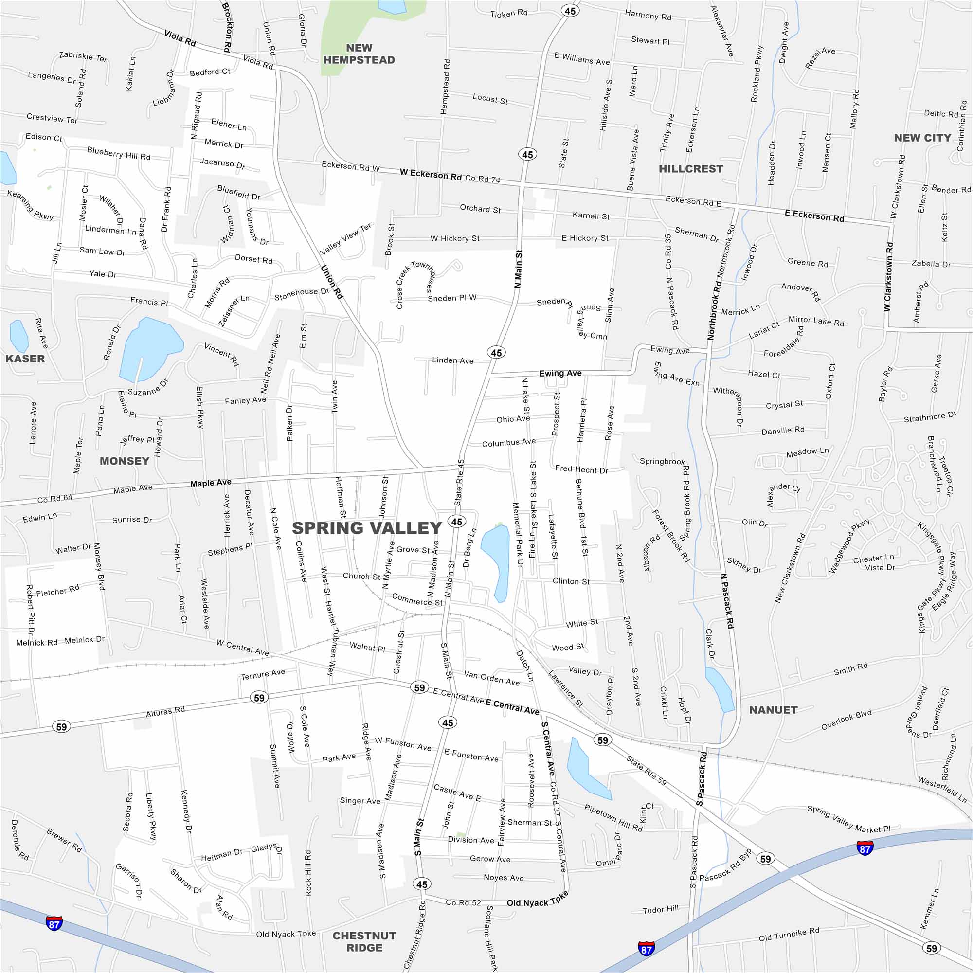
Map Information
On the Map
Interstates/Highways: I-87, State Rte 59, State Rte 45 Major Roads: Eckerson Rd, Central Ave, Church St, Main St, Madison Ave, Funston Ave, Pascack Rd, Chestnut Ridge Rd, Old Nyack Tke, Union Ave, Ewing Ave, Lawrence St, Dutch Ln, Hillside Ave, Williams St, Orchard St, Hickory St, Linden Ave, Maple Ave, Memorial Dr Lakes and Reservoirs: Lake Suzanne Nearby Communities: New Hempstead, Hillcrest, Nanuet, Chestnut Ridge, Monsey, KaserNew York State Maps
Find state maps of the Empire State.


City Maps of New York
Here are the city maps that define New York


