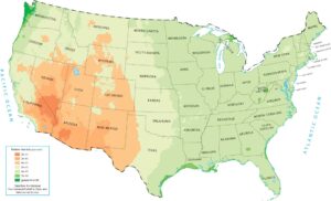
US Biomes Map
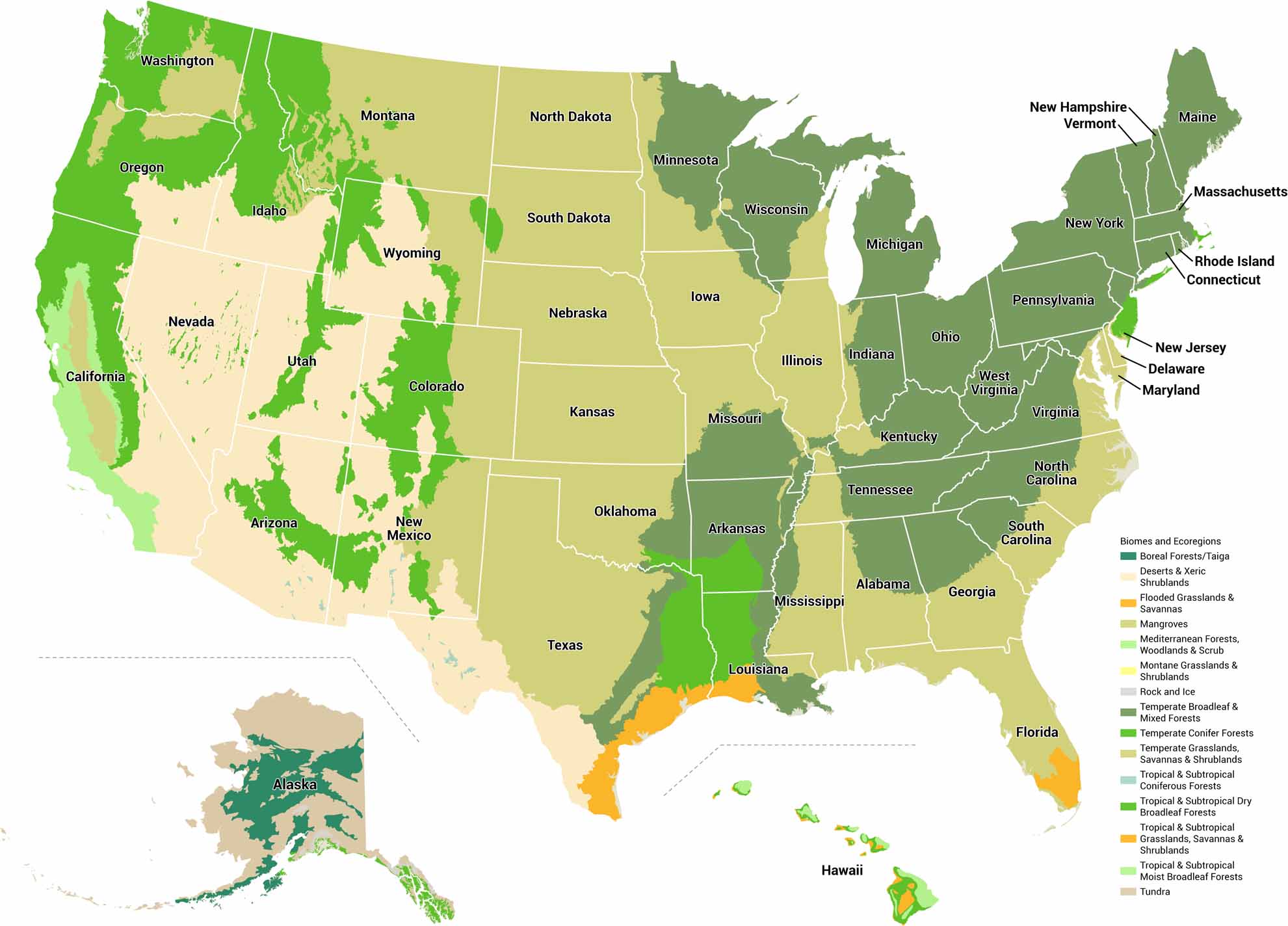
Our US biomes map breaks the landscape into major ecological regions. Boundaries follow patterns of temperature, rainfall, and elevation. Nature draws the lines for this one.
Map Information
US State Biome Maps
Select any state map below to view its biomes map.
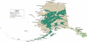


On the Map
Our table below displays the biomes and ecoregions in the United States:|
Biomes |
Ecoregions |
|
Boreal Forests/Taiga |
Alaska Peninsula montane taiga, Cook Inlet taiga, Copper Plateau taiga, Interior Alaska-Yukon lowland taiga, Northern Cordillera forests |
|
Deserts & Xeric Shrublands |
Chihuahuan desert, Colorado Plateau shrublands, Great Basin shrub steppe, Mojave desert, Snake-Columbia shrub steppe, Sonoran desert, Tamaulipan mezquital, Wyoming Basin shrub steppe |
|
Flooded Grasslands & Savannas |
Everglades flooded grasslands |
|
Mangroves |
Bahamian-Antillean mangroves |
|
Mediterranean Forests, Woodlands & Scrub |
California coastal sage and chaparral, California interior chaparral and woodlands, California montane chaparral and woodlands, Santa Lucia Montane Chaparral & Woodlands |
|
Rock and Ice |
Rock and Ice |
|
Temperate Broadleaf & Mixed Forests |
Allegheny Highlands forests, Appalachian-Blue Ridge forests, Appalachian mixed mesophytic forests, Appalachian Piedmont forests, East Central Texas forests, Eastern Canadian Forest-Boreal transition, Eastern Great Lakes lowland forests, Interior Plateau US Hardwood Forests, Mississippi lowland forests, New England-Acadian forests, Northeast US Coastal forests, Ozark Highlands mixed forests, Ozark Mountain forests, Southern Great Lakes forests, Upper Midwest US forest-savanna transition, Western Great Lakes forests |
|
Temperate Conifer Forests |
Arizona Mountains forests, Atlantic coastal pine barrens, Blue Mountains forests, British Columbia coastal conifer forests, Central-Southern Cascades Forests, Central Pacific Northwest coastal forests, Colorado Rockies forests, Eastern Cascades forests, Great Basin montane forests, Klamath-Siskiyou forests, Northern California coastal forests, Piney Woods, Puget lowland forests, Sierra Nevada forests, South Central Rockies forests, Wasatch and Uinta montane forests, Northern Pacific Alaskan coastal forests, North Cascades conifer forests, Northern Rockies conifer forests |
|
Temperate Grasslands, Savannas & Shrublands |
California Central Valley grasslands, Canadian Aspen forests and parklands, Central-Southern US mixed grasslands, Central US forest-grasslands transition, Central Tallgrass prairie, Cross-Timbers savanna-woodland, Edwards Plateau savanna, Flint Hills tallgrass prairie, Mid-Atlantic US coastal savannas, Montana Valley and Foothill grasslands, Nebraska Sand Hills mixed grasslands, Northern Shortgrass prairie, Northern Tallgrass prairie, Palouse prairie, Southeast US mixed woodlands and savannas, Southeast US conifer savannas, Texas blackland prairies, Western shortgrass prairie, Willamette Valley oak savanna |
|
Tropical & Subtropical Coniferous Forests |
Sierra Madre Occidental pine-oak forests, Sierra Madre Oriental pine-oak forests |
|
Tropical & Subtropical Dry Broadleaf Forests |
Hawaii tropical dry forests |
|
Tropical & Subtropical Grasslands, Savannas & Shrublands |
Hawaii tropical high shrublands, Hawaii tropical low shrublands, Western Gulf coastal grasslands |
|
Tropical & Subtropical Moist Broadleaf Forests |
Hawaii tropical moist forests |
|
Tundra |
Ahklun and Kilbuck Upland Tundra, Alaska-St. Elias Range tundra, Aleutian Islands tundra, Arctic coastal tundra, Arctic foothills tundra, Beringia lowland tundra, Beringia upland tundra, Brooks-British Range tundra, Interior Yukon-Alaska alpine tundra, Ogilvie-MacKenzie alpine tundra, Pacific Coastal Mountain icefields and tundra |
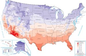
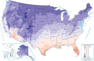
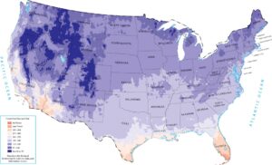
US Climate Maps
Feel the pulse of the nation’s nature.