Map of St. Augustine, Florida
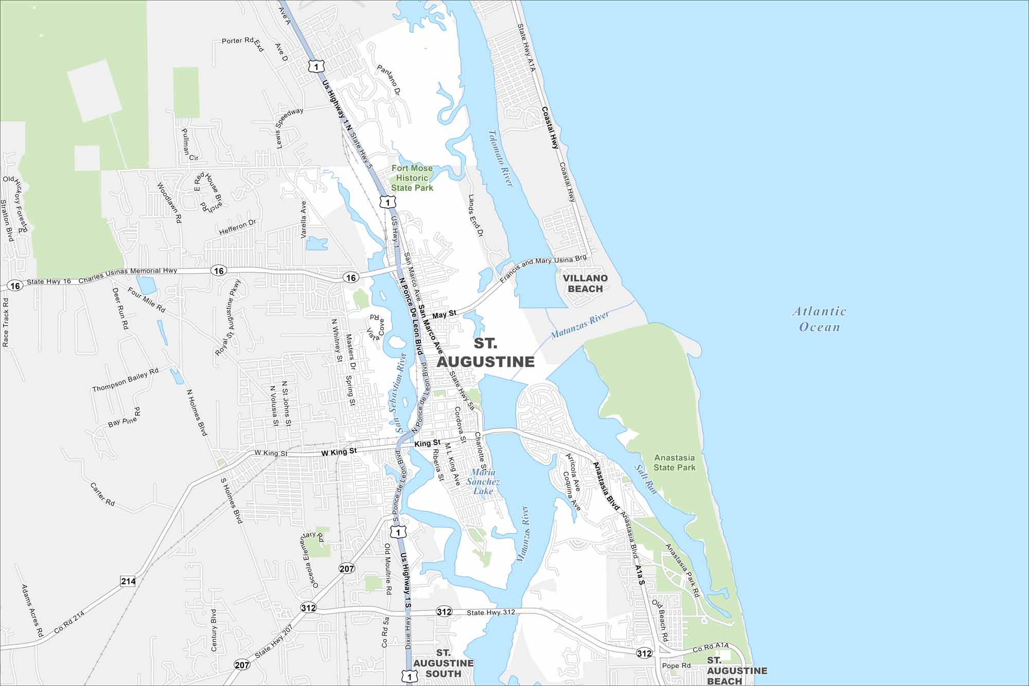
Our map of St. Augustine shows the oldest city in the U.S. It was established back in 1565 by Spanish explorer Pedro Menéndez de Avilés. Cobblestone streets, Spanish forts, and ocean views make it a unique place to explore.
Florida State Maps
Discover Florida through our state maps


Map Information
On the Map
Interstates/Highways: US Hwy 1, State Rte A1A, State Rte 16, State Rte 312, State Rte 207, State Rte 214, State Rte 5, State Rte 5a Major Roads: Ponce De Leon Blvd, King St, San Marco Ave, May St, Anastasia Blvd, Dixie Hwy, West King St, Masters Dr, Varella Ave, Lewis Speedway, Coastal Hwy, Pope Rd, Old Moultrie Rd, Holmes Blvd, Woodlawn Rd, Francis and Mary Usina Brg Airports: Lakes and Reservoirs: Atlantic Ocean, Maria Sanchez Lake Major Rivers: Matanzas River, Salt Run, San Sebastian River, Tolomato River Parks and Preserves: Anastasia State Park, Fort Mose Historic State Park Nearby Communities: Villano Beach, St. Augustine South, St. Augustine BeachFlorida City Maps
Chart your course through Miami and Florida’s cities


