Map of St. Cloud, Florida
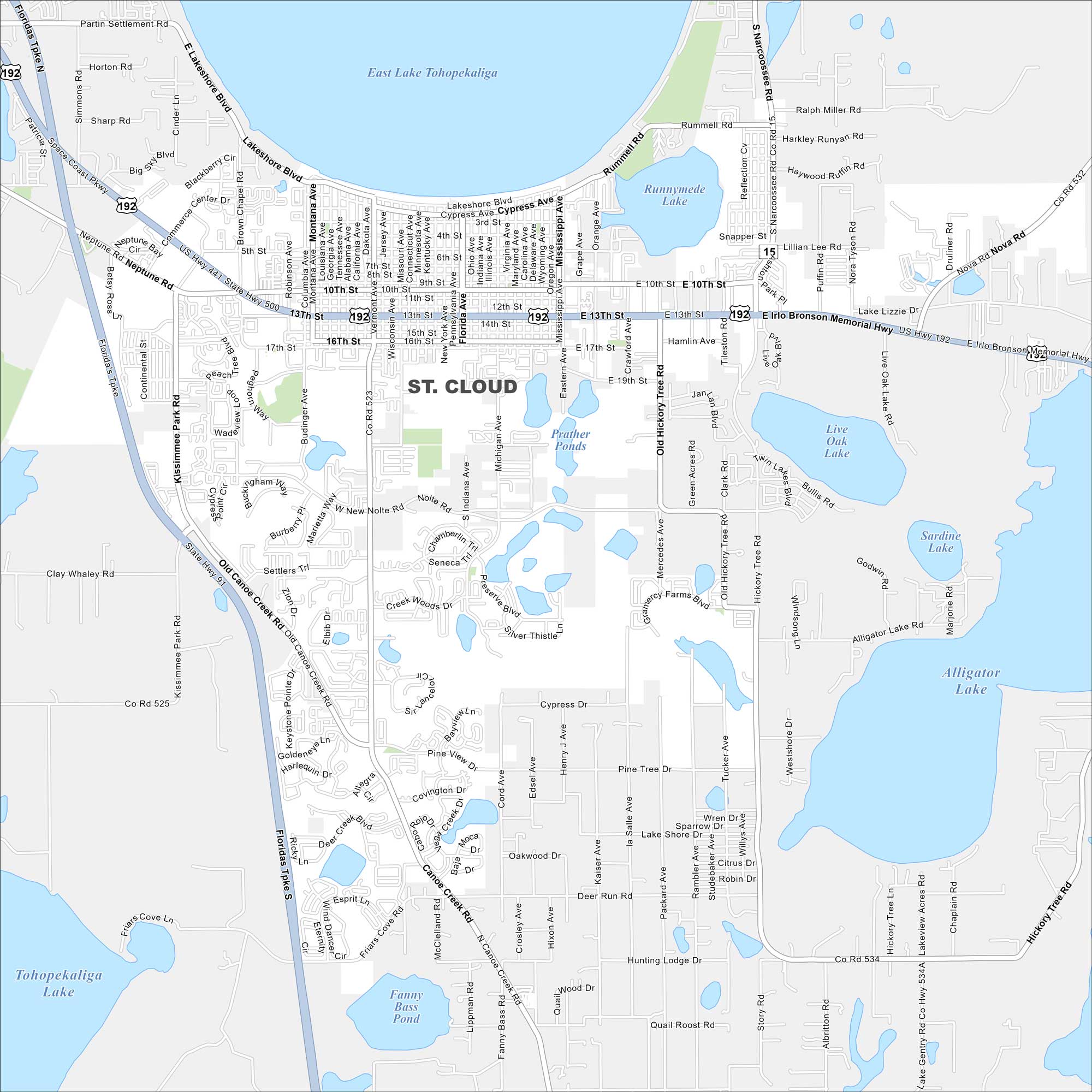
Our road map of St. Cloud helps you explore this growing city near Orlando. It offers a quieter pace with lakes and family neighborhoods. East Lake Tohopekaliga covers a big part of the north.
Florida State Maps
Discover Florida through our state maps


Map Information
On the Map
Interstates/Highways: US Hwy 192, Florida’s Tpke, State Rte 15, State Rte 500, Irlo Bronson Memorial Hwy Major Roads: Old Canoe Creek Rd, Canoe Creek Rd, Nolte Rd, 10th St, 13th St, 17th St, Lakeshore Blvd, Cypress Ave, Budinger Ave, Hickory Tree Rd, Michigan Ave, Narcoossee Rd, Vermont Ave, Delaware Ave, Eastern Ave, New Nolte Rd, Neptune Rd, Clay Whaley Rd Lakes and Reservoirs: East Lake Tohopekaliga, Tohopekaliga Lake, Alligator Lake, Lake Lizzie, Live Oak Lake, Sardine Lake, Runnymede Lake, Prather Ponds, Fanny Bass PondFlorida City Maps
Chart your course through Miami and Florida’s cities


