Sequoia National Park Map
Download our map of Sequoia National Park with roads, trails, campgrounds. In California’s Sierra Nevada, massive groves, deep canyons, and high peaks fill the landscape.
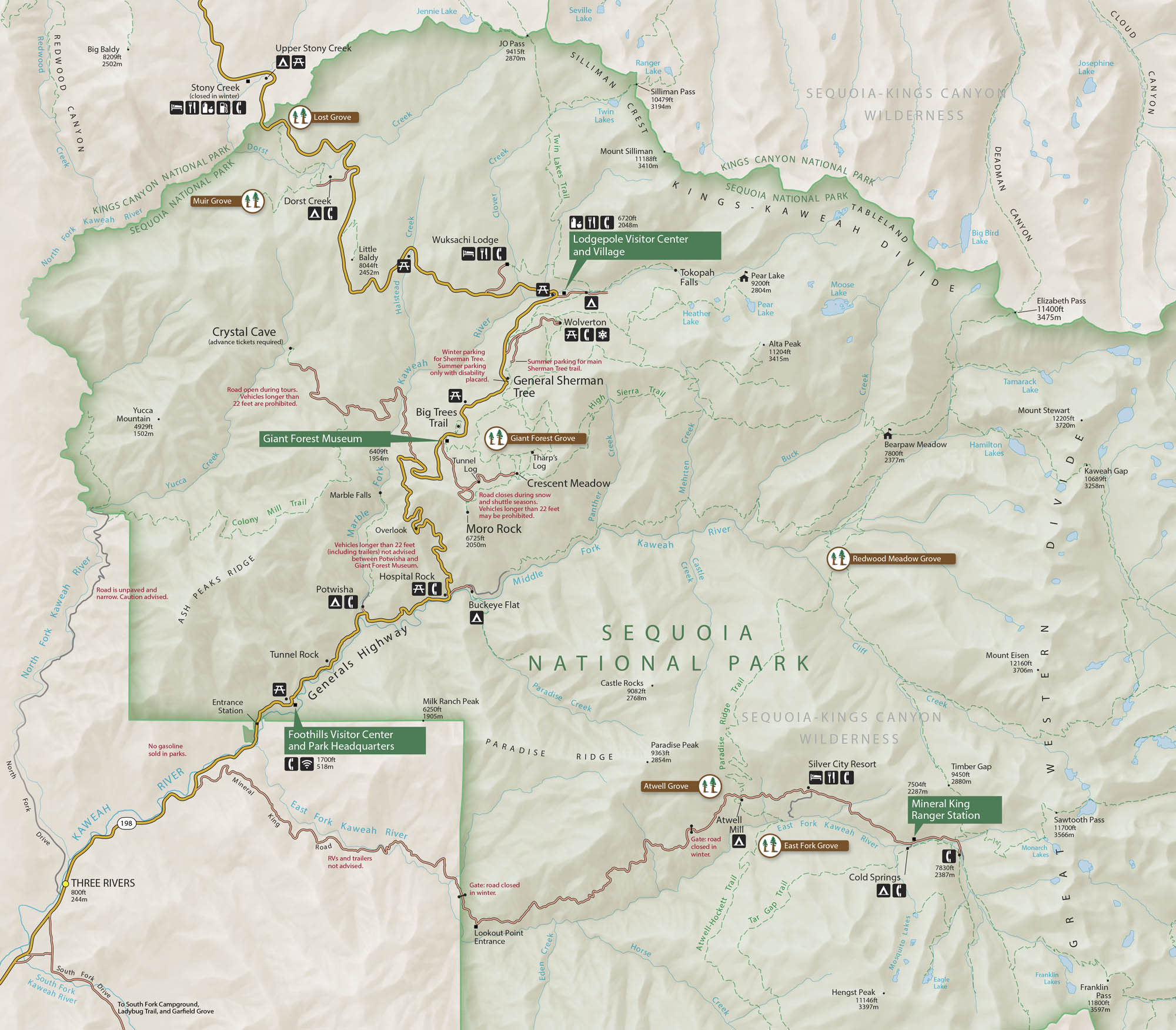
Map Information
On the Map
Parks: Sequoia National Park, Kings Canyon National Park Visitor Centers: Lodgepole Visitor Center and Village, Giant Forest Museum, Foothills Visitor Center and Park Headquarters Major Roads: Generals Hwy, State Rte 198, Mineral King Rd Rivers/Lakes: Kaweah River, Middle Fork Kaweah River, Marble Fork Kaweah River, East Fork Kaweah River, South Fork Kaweah River, Pear Lake, Heather Lake, Aster Lake, Twin Lakes, Jennings Lake Cities/Towns: Three Rivers, Silver City Resort Campgrounds/Park Sites: Lodgepole, Dorst Creek, Potwisha, Buckeye Flat, Cold Springs, Atwell Mill, South Fork Campground, Crystal Cave, Wolverton, Crescent Meadow Other Landmarks: General Sherman Tree, Moro Rock, Giant Forest Grove, Hospital Rock, Tunnel Log, Tunnel Rock, Tharp’s Log, Tokopah Falls, Mount Silliman, Alta Peak, Great Western DivideNational Park Maps
Find maps of green spaces and national parks near you.


