American Samoa National Park Map
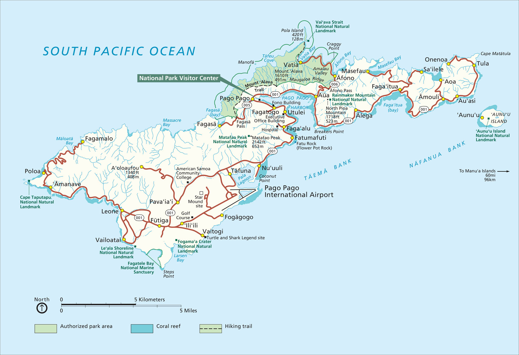
Far out in the South Pacific, the American Samoa National Park feels completely untouched. Our park map shows hiking trails, coral reefs, and key visitor points.
Map Information
On the Map
Major Roads: Rte 001, Rte 005, Rte 006 Bays/Oceans: South Pacific Ocean, Pago Pago Harbor, Vatia Bay, Afono Bay, Masefau Bay, Fagaitua Bay, Larsen Bay, Fagatele Bay, Massacre Bay, Fagasa Bay, Taema Bank, Nafanua Bank Parks: National Park of American Samoa, Fagatele Bay National Marine Sanctuary Visitor Centers: National Park Visitor Center Cities/Towns: Pago Pago, Fagatogo, Utulei, Faga’alu, Tafuna, Leone, Vaitogi, Faga’itua, Aoa, Tula, Vatia, Afono, Fagasa, Amanave, Poloa, Vailoatai, Futiga Campgrounds/Park Specific Sites: Mount Alava, Rainmaker Mountain, North Pioa Mountain, Matafao Peak, Fatu Rock, Flower Pot Rock, Pola Island, Aunu’u IslandOthers: Pago Pago International Airport, American Samoa Community College
National Park Maps
Find maps of green spaces and national parks near you.


