Acadia National Park Map
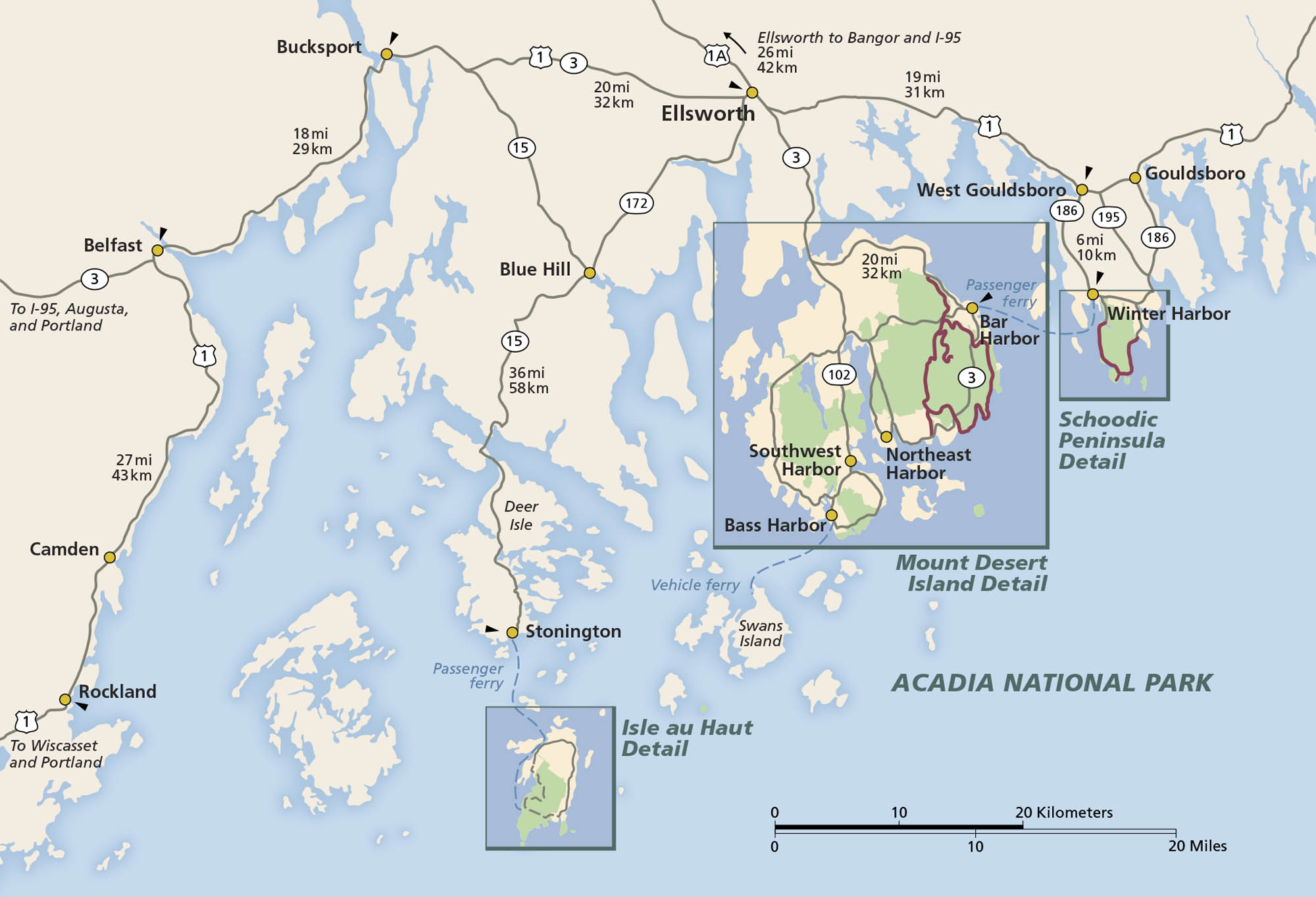
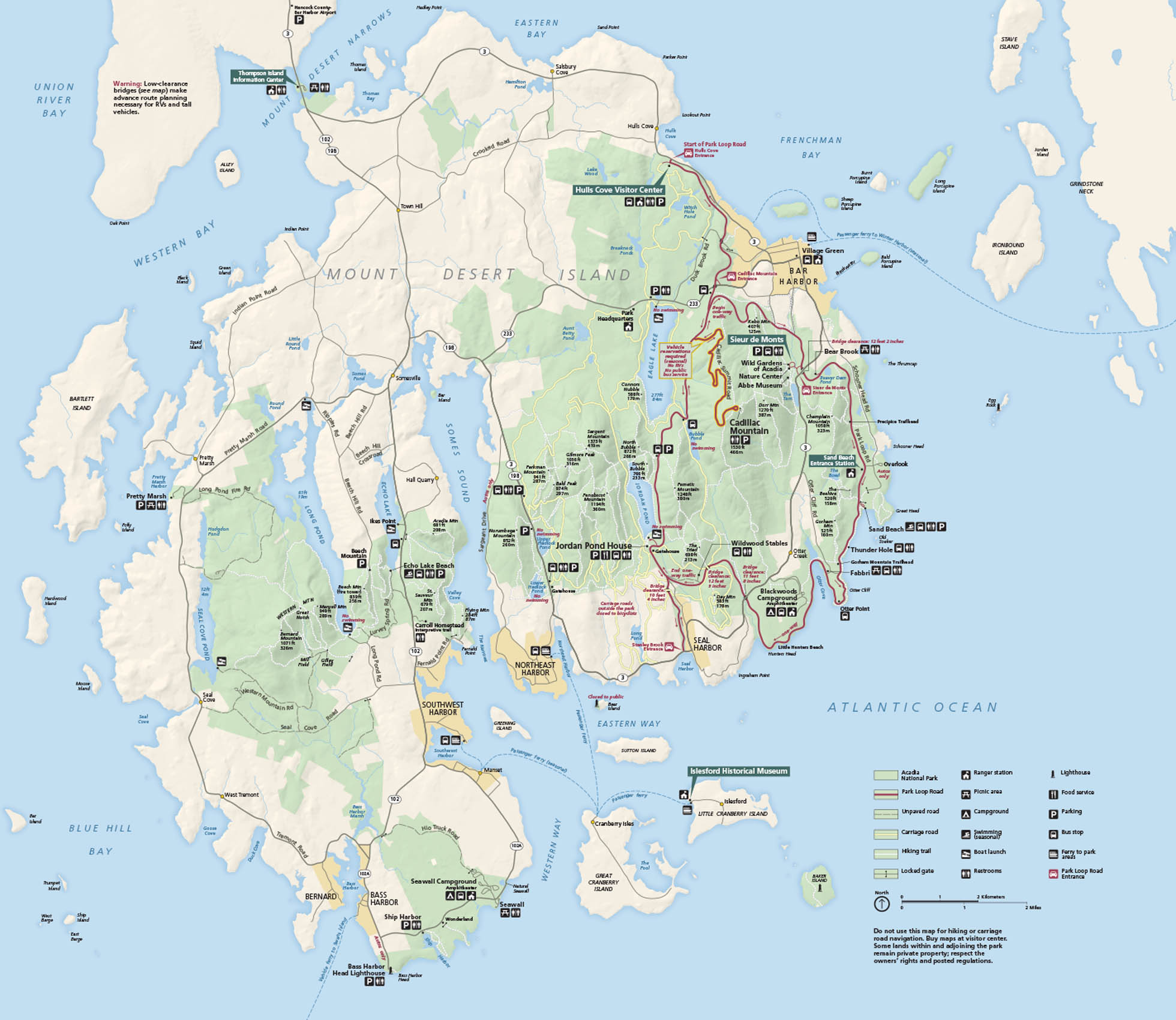
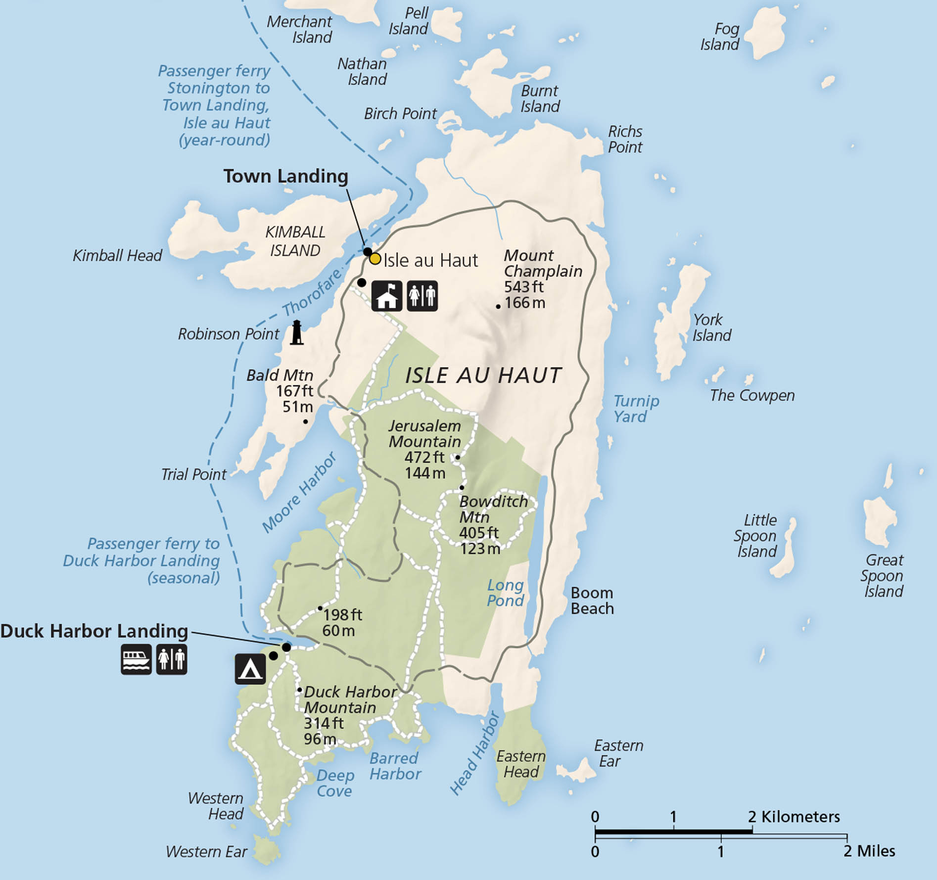
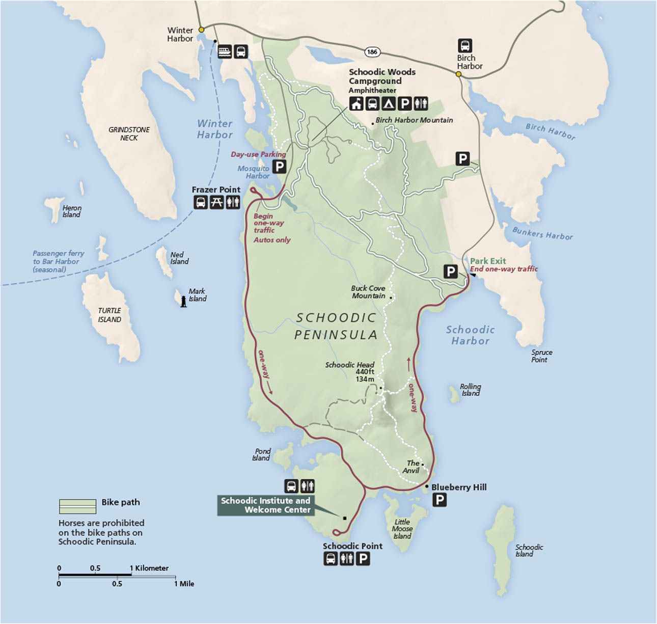
Acadia National Park is located off the coast of Maine. It’s known for its rocky shores, forests, lakes, and summit views. Our map splits out the park into three islands- (1) Mount Desert Island, (2) Isle au Haut and (3) Schoodic Peninsula.
Map Information
On the Map
Major Roads: US Hwy 1, State Rte 3, State Rte 102, State Rte 15, State Rte 1A, State Rte 172, State Rte 186, State Rte 195 Harbors: Bar Harbor, Northeast Harbor, Southwest Harbor, Bass Harbor, Winter Harbor Parks: Acadia National Park Cities/Towns: Ellsworth, Bucksport, Belfast, Camden, Rockland, Stonington, Gouldsboro, West Gouldsboro, Blue Hill, Deer Isle Islands and Peninsulas: Mount Desert Island, Schoodic Peninsula, Isle au Haut, Swans IslandNational Park Maps
Find maps of green spaces and national parks near you.


