Arches National Park Map
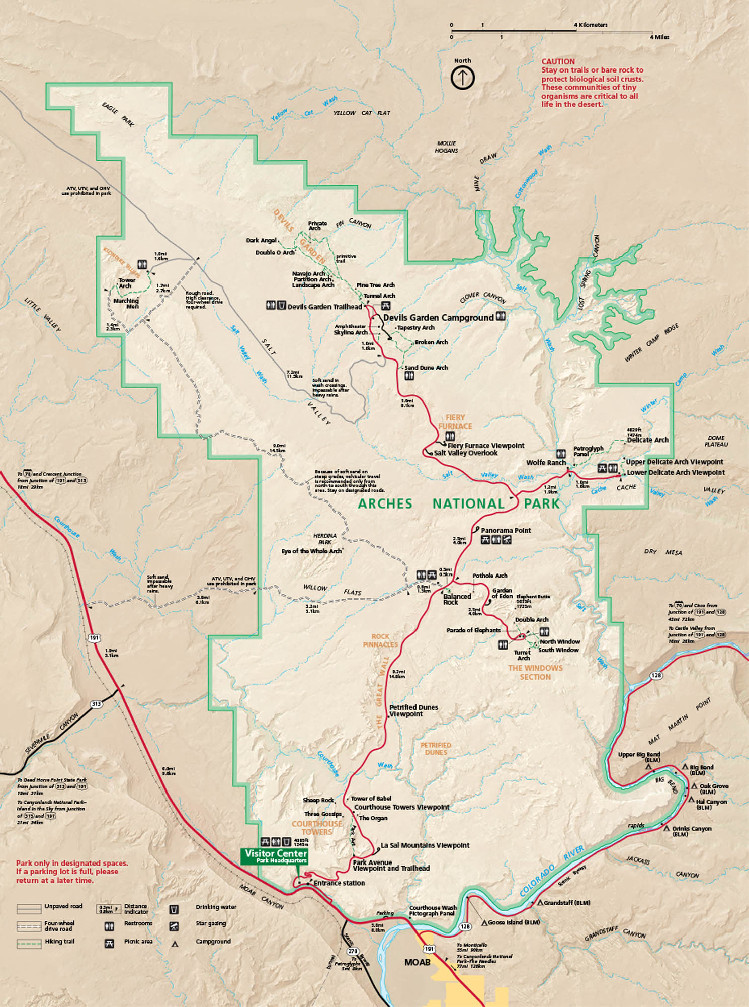
Arches National Park is located near Moab, Utah. This national park holds towers, cliffs, and more than two thousand arches. Our national park map includes roads, trails, and star gazing sites.
Map Information
On the Map
Major Roads: US Hwy 191, State Rte 128, State Rte 313, State Rte 279 Rivers/Washes: Colorado River, Salt Wash, Courthouse Wash, Winter Camp Wash Parks: Arches National Park, Dead Horse Point State Park, Canyonlands National Park Visitor Centers: Visitor Center (Park Headquarters) Cities/Towns: Moab Campgrounds/Landmarks: Devils Garden Campground, Delicate Arch, Landscape Arch, Balanced Rock, Double Arch, The Windows, Courthouse Towers, Fiery Furnace, Tower of Babel, The Organ, Three Gossips, Sheep Rock Other Landmarks: Salt Valley, Fiery Furnace Viewpoint, Panorama Point, Petrified Dunes Viewpoint, La Sal Mountains Viewpoint, Sevenmile CanyonNational Park Maps
Find maps of green spaces and national parks near you.


