Badlands National Park Map
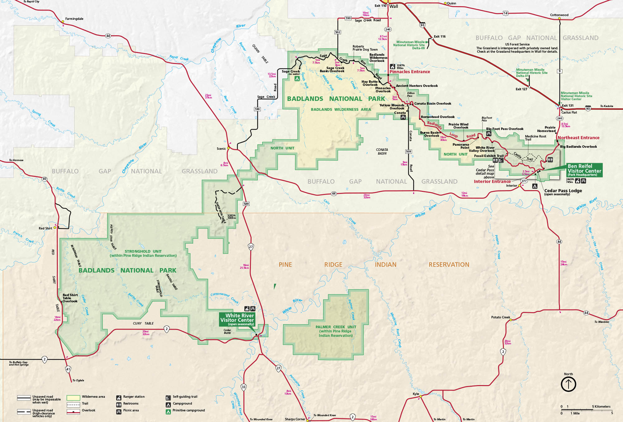
In southwestern South Dakota, the Badlands stretch across layered rock, grasslands, and wide prairie views. Our map shows overlooks, trails, roads, campgrounds, and the main routes to get there.
Map Information
On the Map
Interstates/Highways: I-90 Major Roads: State Rte 44, State Rte 240, State Rte 377, State Rte 27, State Rte 41 Rivers/Creeks: White River, Cheyenne River, Bear Creek, Potato Creek, Medicine Root Creek Parks: Badlands National Park, Buffalo Gap National Grassland, Minidoka National Historic Site, Stronghold Unit, Palmer Creek Unit Visitor Centers: Ben Reifel Visitor Center, White River Visitor Center Cities/Towns: Wall, Interior, Scenic, Cactus Flat, Kadoka, Sharps Corner, Kyle Campgrounds/Park Sites: Cedar Pass Lodge, Sage Creek Campground, Ancient Hunters Overlook, Pinnacles Overlook, Yellow Mounds Overlook, Conata Basin Overlook, Big Badlands Overlook Others: Pine Ridge Indian ReservationNational Park Maps
Find maps of green spaces and national parks near you.


