Biscayne National Park Map
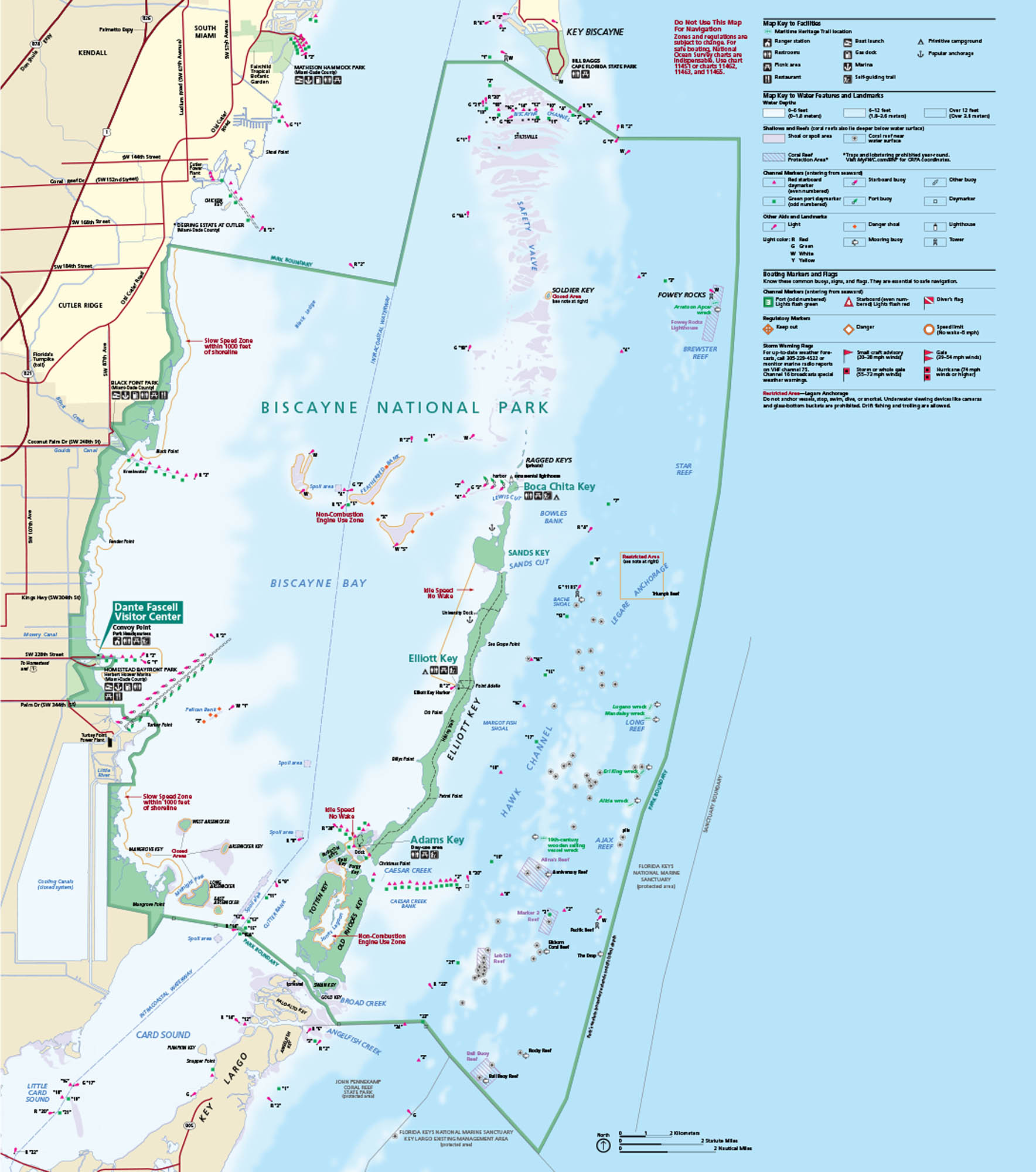
Biscayne sits off the coast of Miami with reefs, keys, mangroves, and bright blue shallows. Our Biscayne National Park map highlights boat launches, marines and more.
Map Information
On the Map
Major Roads: US Hwy 1, State Rte 821 (Florida’s Turnpike), SW 87th Ave, SW 137th Ave, SW 152nd St, SW 328th St (North Canal Dr) Bays/Sounds: Atlantic Ocean, Biscayne Bay, Card Sound, Little Card Sound, Hawk Channel Parks: Biscayne National Park, John Pennekamp Coral Reef State Park, Bill Baggs Cape Florida State Park Visitor Centers: Dante Fascell Visitor Center Cities/Towns: Homestead, Cutler Ridge, Kendall, Key Biscayne, Key Largo Campgrounds/Park Specific Sites: Elliott Key, Boca Chita Key, Adams Key, Sands Key, Soldier Key, Fowey Rocks, Star Reef, Pacific Reef Other Landmarks: Turkey Point Power Plant, Black Point Park, Convoy PointNational Park Maps
Find maps of green spaces and national parks near you.


