Black Canyon of the Gunnison National Park Map
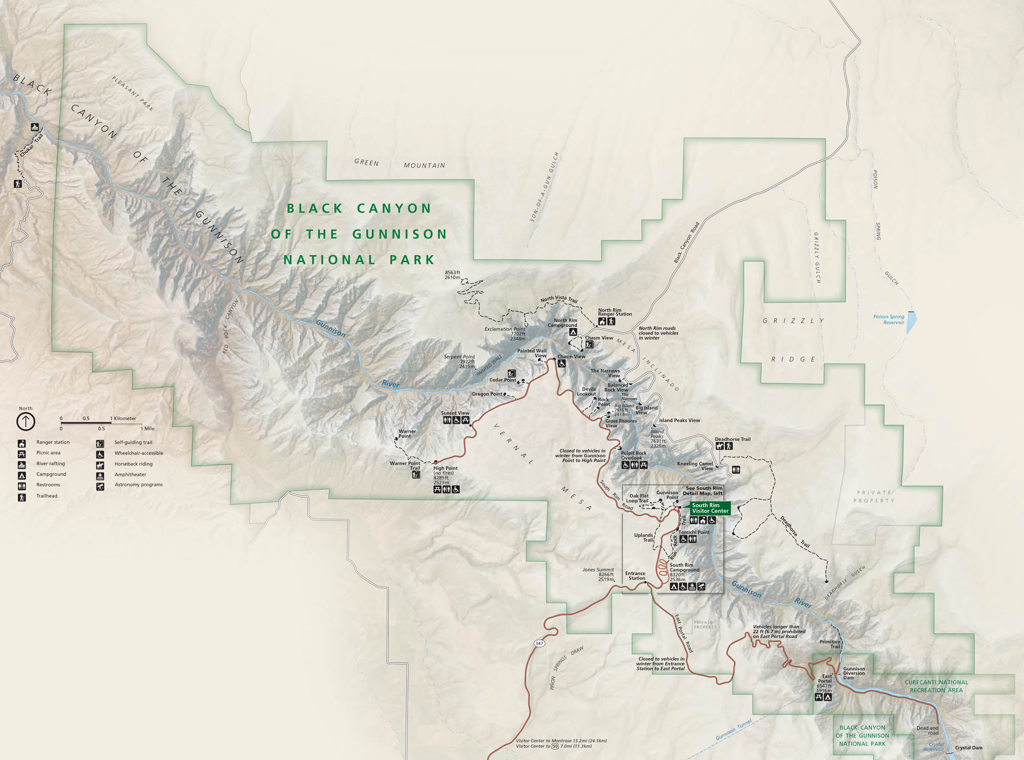
In western Colorado, the Gunnison River carves a narrow, dark canyon. This is the location of Black Canyon of the Gunnison National Park. Use our park map to check out overlooks, trails, and roads.
Map Information
On the Map
Major Roads: State Rte 92, US Hwy 50 Rivers/Dams: Gunnison River, Crystal Dam Parks: Black Canyon of the Gunnison National Park, Curecanti National Recreation Area Visitor Centers: South Rim Visitor Center Campgrounds/Park Specific Sites: North Rim Campground, South Rim Campground, East Portal, Painted Wall, Dragon Point, Sunset View, High Point, Pulpit Rock Overlook, Chasm View Other Landmarks: Vernal Mesa, Grizzly Ridge, Green Mountain, Deadhorse TrailNational Park Maps
Find maps of green spaces and national parks near you.


