Channel Islands National Park Map
Our map of Channel Islands National Park guides you through California’s wild offshore world. These islands hold sea cliffs, quiet coves, sea caves, and rugged backcountry terrain. Our map features everything from ranger stations to campgrounds and restrooms.
Map Information
On the Map
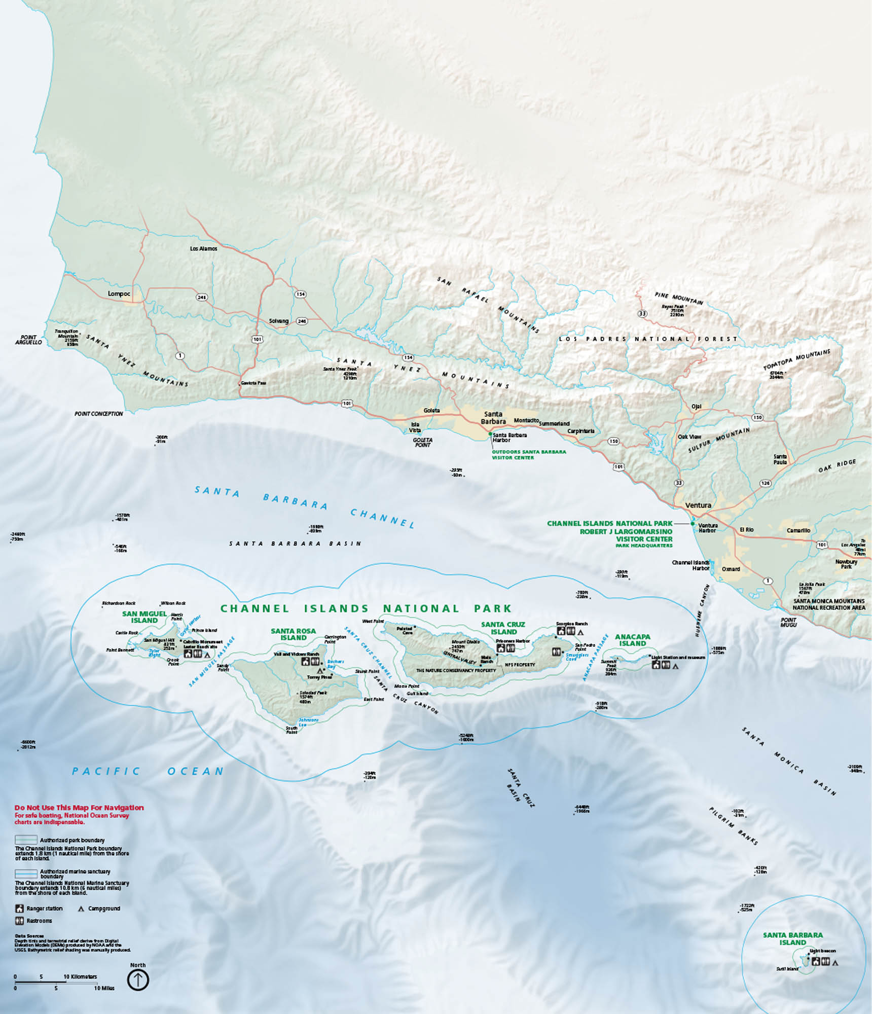
Visitor Centers: Robert J. Lagomarsino Visitor Center, Outdoors Santa Barbara Visitor Center Parks: Channel Islands National Park, Los Padres National Forest, Santa Monica Mountains National Recreation Area Interstates/Highways: US Hwy 101 Major Roads: State Rte 1, State Rte 33, State Rte 150, State Rte 126, State Rte 232, State Rte 34, State Rte 154, State Rte 246 Passages/Oceans: Pacific Ocean, Santa Barbara Channel, Santa Cruz Channel, Anacapa Passage, San Miguel Passage, Cuyler Harbor, Bechers Bay, Scorpion Anchorage, Smugglers Cove Cities/Towns: Santa Barbara, Ventura, Oxnard, Camarillo, Goleta, Carpinteria, Ojai, Solvang, Lompoc Islands: San Miguel Island, Santa Rosa Island, Santa Cruz Island, Anacapa Island, Santa Barbara Island Mountains: Santa Ynez Mountains, San Rafael Mountains, Pine Mountain, Topatopa Mountains Others: Santa Cruz Basin, Inspiration Point, Cavern PointNational Park Maps
Find maps of green spaces and national parks near you.


