Congaree National Park Map
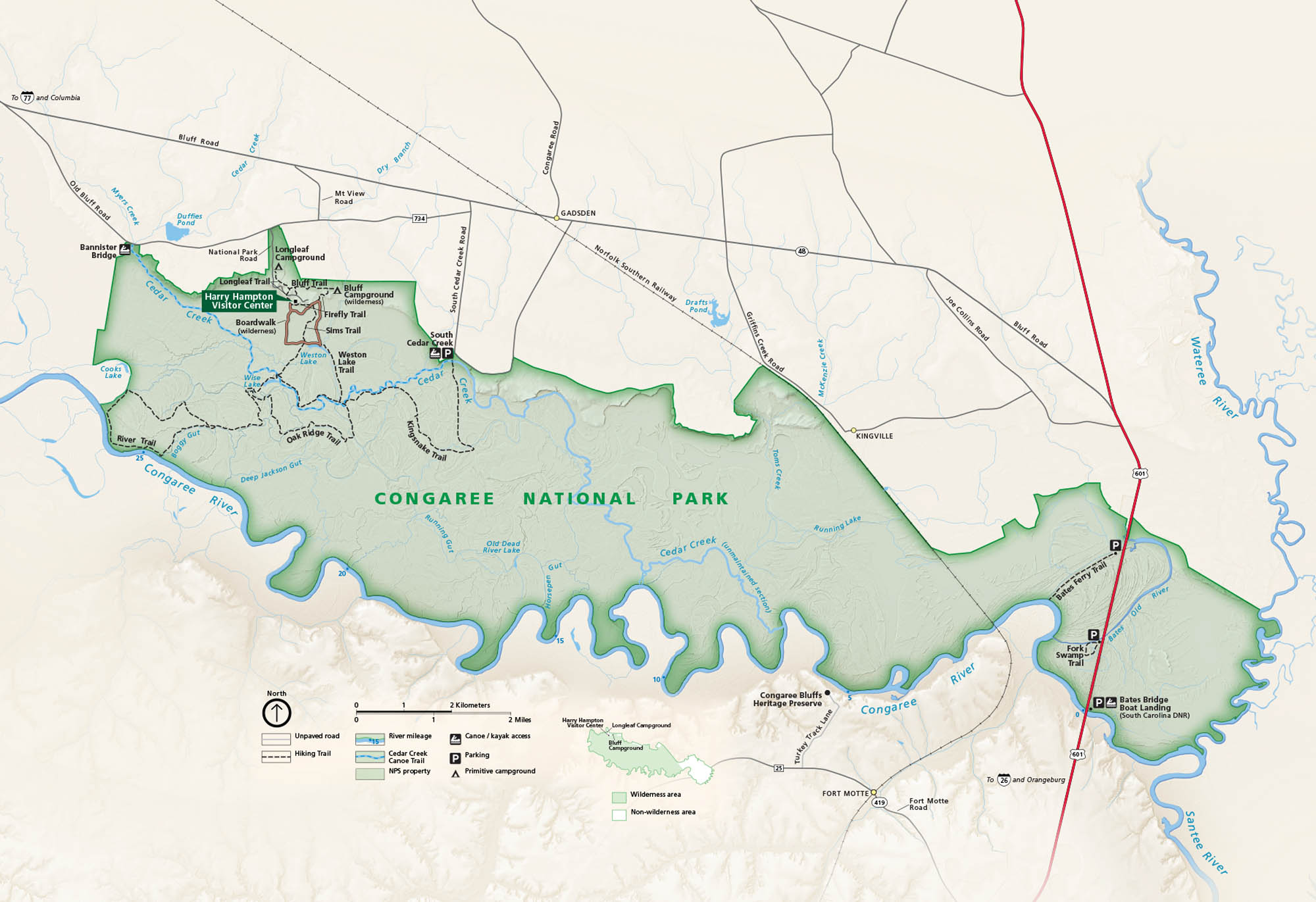
Step quietly into the forest. In central South Carolina, Congaree protects massive hardwoods and its slow floodplains. Our map shows everything from trails to roads and parking.
Map Information
On the Map
Major Roads: US Hwy 601, Bluff Rd, Old Bluff Rd, Congaree Rd, Gadsden Hwy, South Cedar Creek Rd Rivers/Lakes: Congaree River, Cedar Creek, Wateree River, Weston Lake, Wise Lake, Running Lake, Santee River Parks: Congaree National Park, Congaree Bluffs Heritage Preserve Visitor Centers: Harry Hampton Visitor Center Cities/Towns: Columbia, Gadsden, Kingville, Fort Motte Campgrounds/Park Specific sites: Longleaf Campground, Bluff Campground, Boardwalk, Sims Trail, Weston Lake Trail, Oak Ridge Trail, Kingsnake Trail, River Trail, Bates Ferry Trail Others: Bates Bridge Boat Landing, Fork SwampNational Park Maps
Find maps of green spaces and national parks near you.


