Death Valley National Park Map
Heat defines this vast desert. In fact, summer temperatures here regularly exceed 120°F. This makes it one of the hottest places on Earth.
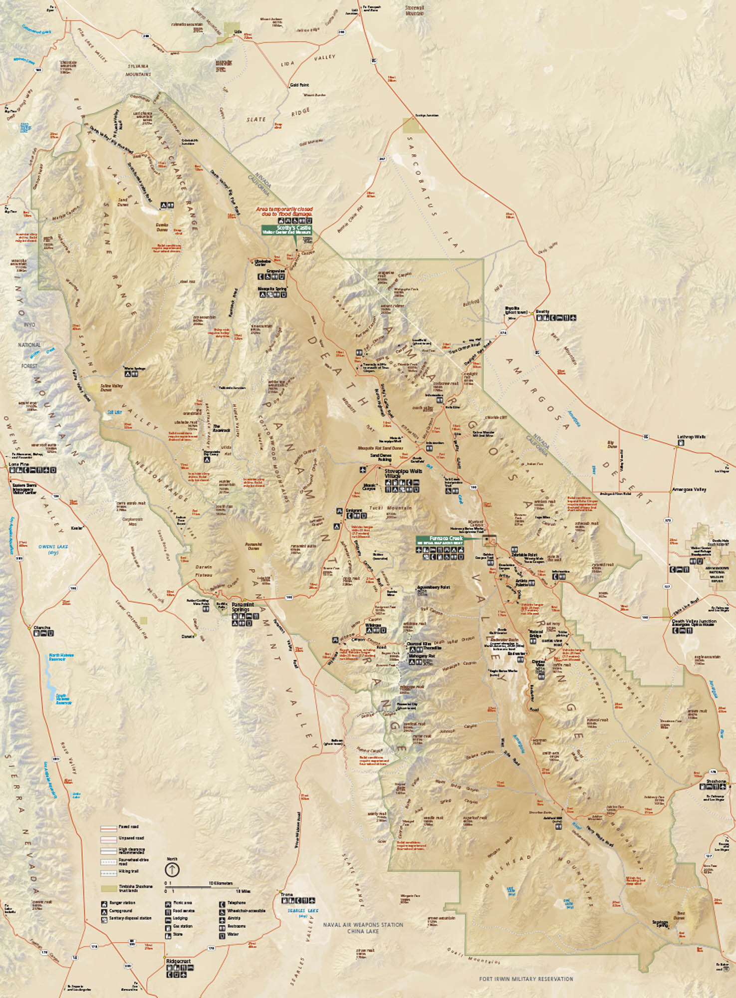
Map Information
On the Map
Interstates/Highways: US Hwy 395, US Hwy 95 Major Roads: State Rte 190, State Rte 178, State Rte 127, State Rte 136, Badwater Rd, Scotty’s Castle Rd, North Hwy, Beatty Rd, Daylight Pass Rd, West Side Rd, Trona Wildrose Rd, Panamint Valley Rd Creeks/Lakes: Badwater Basin, Salt Creek, Owens Lake, Searles Lake Parks: Death Valley National Park, Inyo National Forest Visitor Centers: Furnace Creek Visitor Center, Shoshone Museum Cities/Towns: Furnace Creek, Stovepipe Wells, Panamint Springs, Beatty, Shoshone, Lone Pine, Olancha, Ridgecrest, Death Valley Junction Campgrounds/Park Specific sites: Furnace Creek Campground, Sunset Campground, Texas Spring Campground, Stovepipe Wells Campground, Mesquite Spring Campground, Wildrose Campground, Badwater Basin, Zabriskie Point, Dante’s View, Artist’s Palette, Mesquite Flat Sand Dunes, Ubehebe Crater, Scotty’s Castle Other Landmarks: Panamint Range, Amargosa Range, Cottonwood Mountains, Last Chance Range, Funeral Mountains, Saline Valley, Eureka ValleyNational Park Maps
Find maps of green spaces and national parks near you.


