Gates of the Arctic National Park and Preserve Map
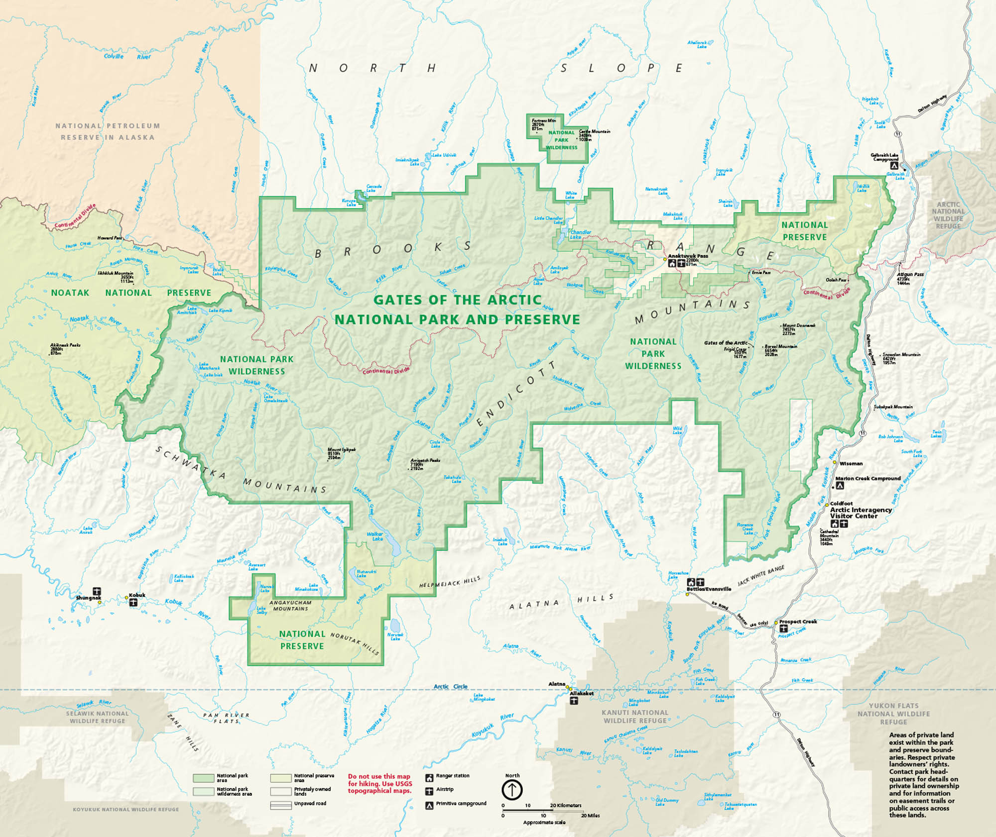
Set entirely above the Arctic Circle in northern Alaska, the park is all tundra, mountains, and untouched wilderness. Silence defines this place. Our national park map marks rivers, lakes, routes, and the continental divide.
Map Information
On the Map
Parks: Gates of the Arctic National Park and Preserve, Noatak National Preserve, Kobuk Valley National Park, Kanuti National Wildlife Refuge, Arctic National Wildlife Refuge Visitor Centers: Arctic Interagency Visitor Center (Coldfoot) Park Sites: Arrigetch Peaks, Mount Igikpak, Doonerak Mountain, Boreal Mountain, Frigid Crags, Endicott Mountains, Schwatka Mountains, Alatna Hills, Helpmejack Hills, Angayucham Hills Major Roads: Dalton Hwy Rivers/Lakes: Alatna River, John River, Kobuk River, Noatak River, Killik River, Nigu River, Itkillik River, Colville River, Koyukuk River, Walker Lake, Selby Lake, Nutuvukti Lake, Takahula Lake, Kurupa Lake Cities/Towns: Coldfoot, Wiseman, Anaktuvuk Pass, Bettles/Evansville, Alatna, Allakaket, Shungnak, Kobuk Landmarks: Continental Divide, Arctic Circle, National Petroleum Reserve in AlaskaNational Park Maps
Find maps of green spaces and national parks near you.


