Map of Stuart, Florida
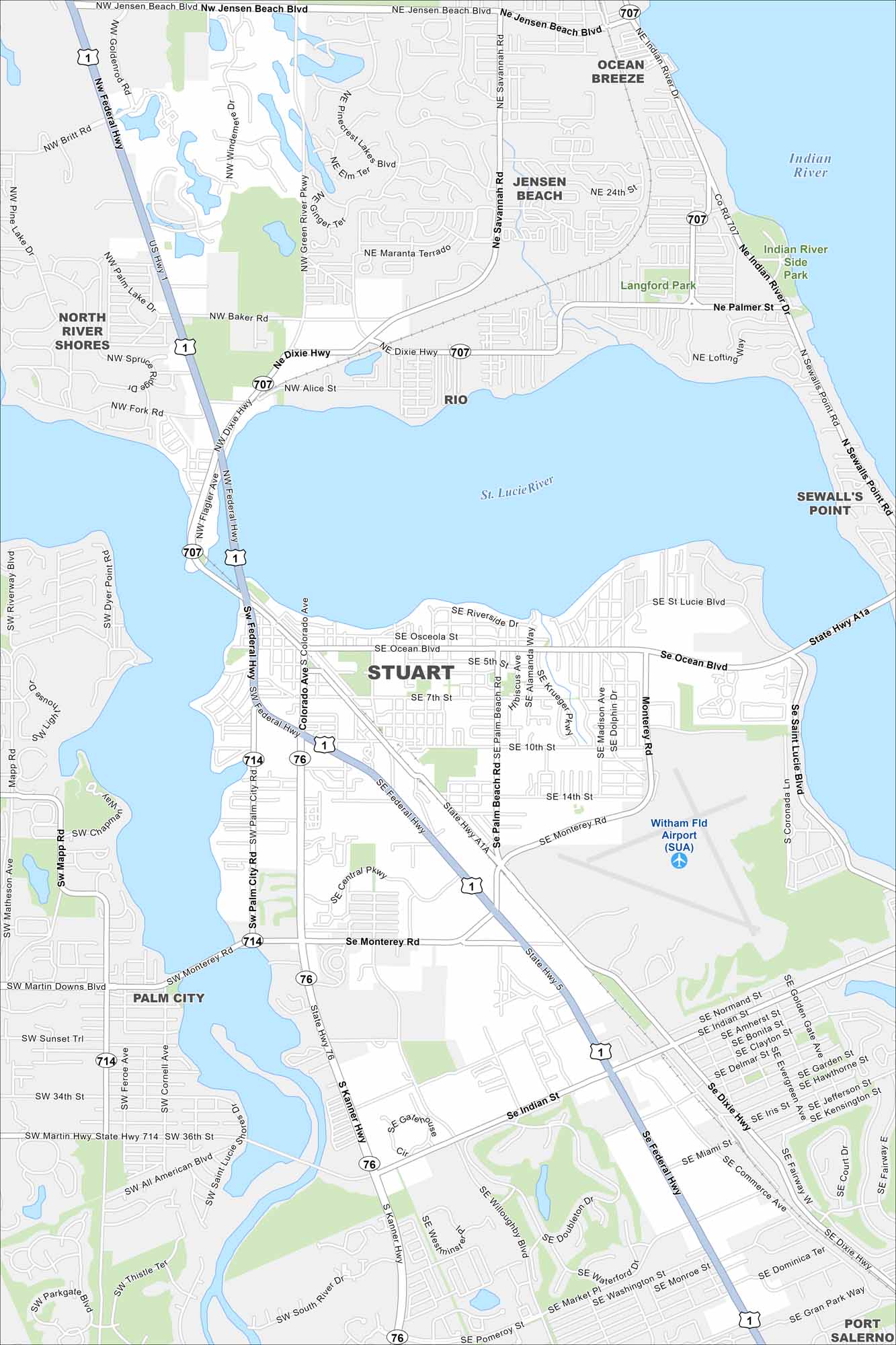
Our map of Stuart highlights the downtown near the St. Lucie River. This coastal city is known as the Sailfish Capital of the World.
Florida State Maps
Discover Florida through our state maps


Map Information
On the Map
Interstates/Highways: US Hwy 1, Federal Hwy, Dixie Hwy, Kanner Hwy Major Roads: Monterey Rd, Indian St, Ocean Blvd, State Hwy A1A, Palm City Rd, Savannah Rd, Jensen Beach Blvd, Colorado Ave, Alice St, Baker Rd, Wright Blvd, Britt Rd, 10th St, 14th St, Willoughby Blvd, Pomeroy St, Salerno Rd Airports: Witham Fld Airport (SUA) Major Rivers: Indian River, St. Lucie River Parks and Preserves: Langford Park, Indian River Side Park Nearby Communities: Jensen Beach, Ocean Breeze, North River Shores, Rio, Sewall’s Point, Palm City, Port SalernoFlorida City Maps
Chart your course through Miami and Florida’s cities


