Hot Springs National Park Map
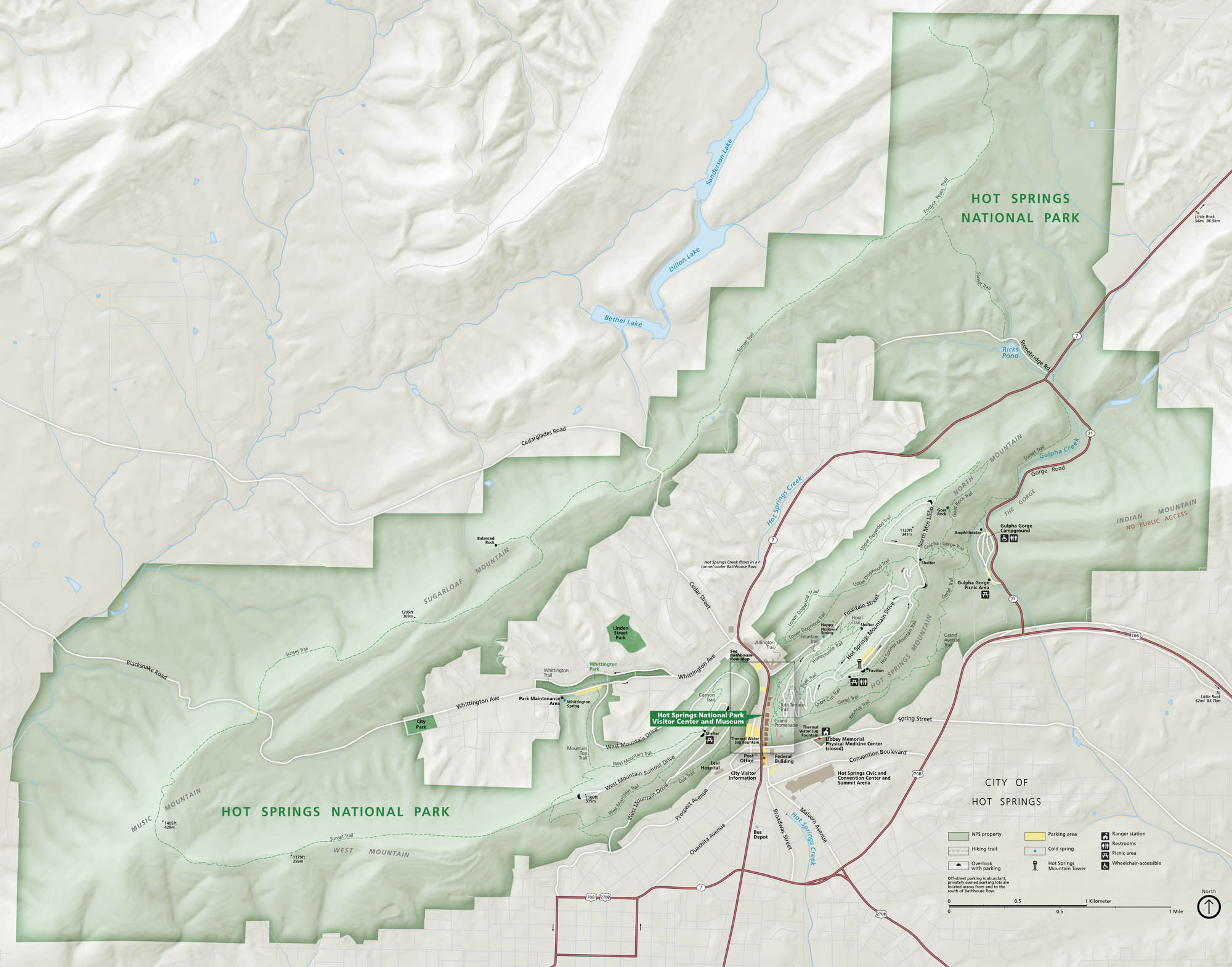
Set in central Arkansas, Hot Springs National Park wraps around Bathhouse Row, forested hills, and the warm waters that made the city famous. Our park map shows trails, roads, bathhouses, overlooks, and picnic areas.
Map Information
On the Map
Highways: US Hwy 70, US Hwy 270, State Rte 7, State Rte 128 Major Roads: West Mountain Summit Drive, North Mountain Drive, Fountain St, Central Ave, Exchange St, Reserve St, Whittington Ave, Grand Ave, Malvern Ave, Ouachita Ave Lakes/Creeks: Sanderson Lake, Dillon Lake, Bethel Lake, Gulpha Creek, Hot Springs Creek Parks: Hot Springs National Park Visitor Centers: Hot Springs National Park Visitor Center and Museum Cities/Towns: City of Hot Springs Campgrounds/Park Sites: Gulpha Gorge Campground, Bathhouse Row, Libbey Memorial Physical Medicine Center Other Landmarks: Hot Springs Mountain Tower, West Mountain, North Mountain, Sugarloaf Mountain, Music Mountain, Indian Mountain, The Gorge, Tufa TerraceNational Park Maps
Find maps of green spaces and national parks near you.


