Indiana Dunes National Park Map
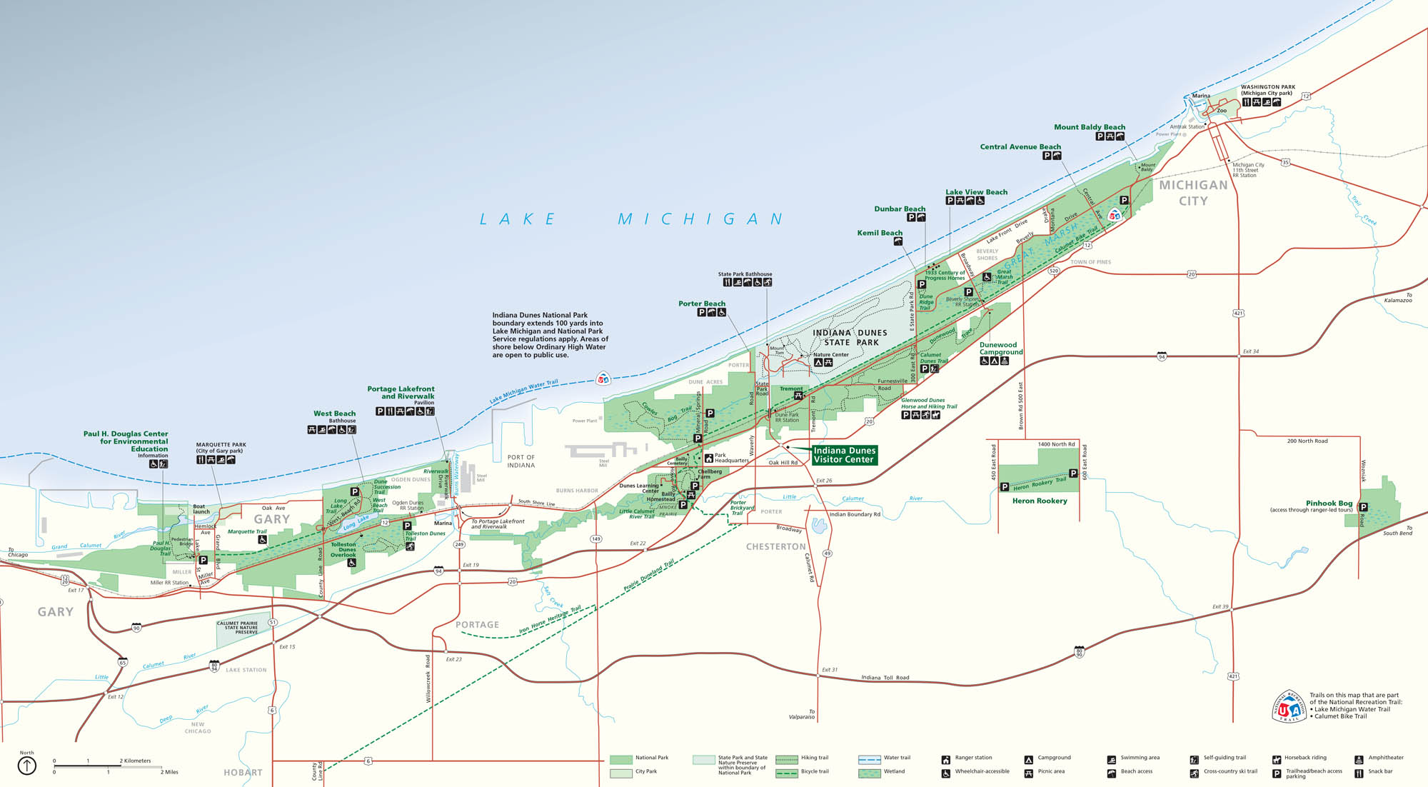
Indiana Dunes National Park unfolds along the southern edge of Lake Michigan. As you may have expected, our map stretches across the shoreline. You’ll find everything from trails and beaches to roads and parking areas.
Map Information
On the Map
Interstates/Highways: I-94, I-90, I-65, US Hwy 12, US Hwy 20 Major Roads: State Rte 49, State Rte 249, State Rte 149, State Rte 51, State Rte 2, State Rte 110, State Rte 520, State Rte 212, Dunes Hwy, Melton Rd, Broadway, Willowcreek Rd, Mineral Springs Rd, Waverly Rd, Kemil Rd, Central Ave, Lake Shore Dr Rivers/Lakes: Lake Michigan, Little Calumet River, Grand Calumet River, Salt Creek, Long Lake Parks: Indiana Dunes National Park, Indiana Dunes State Park, Marquette Park, Cowles Bog, Heron Rookery, Pinhook Bog, Blagden Preserve Visitor Centers: Indiana Dunes Visitor Center, Paul H. Douglas Center for Environmental Education Cities/Towns: Gary, Portage, Chesterton, Michigan City, Porter, Burns Harbor, Town of Pines, Beverly Shores, Hobart, New Chicago, Lake Station Campgrounds/Park Sites: Dunewood Campground, West Beach, Portage Lakefront and Riverwalk, Porter Beach, Kemil Beach, Dunbar Beach, Lake View Beach, Central Avenue Beach, Mount Baldy Beach, Bailly Homestead, Chellberg FarmNational Park Maps
Find maps of green spaces and national parks near you.


