Isle Royale National Park Map
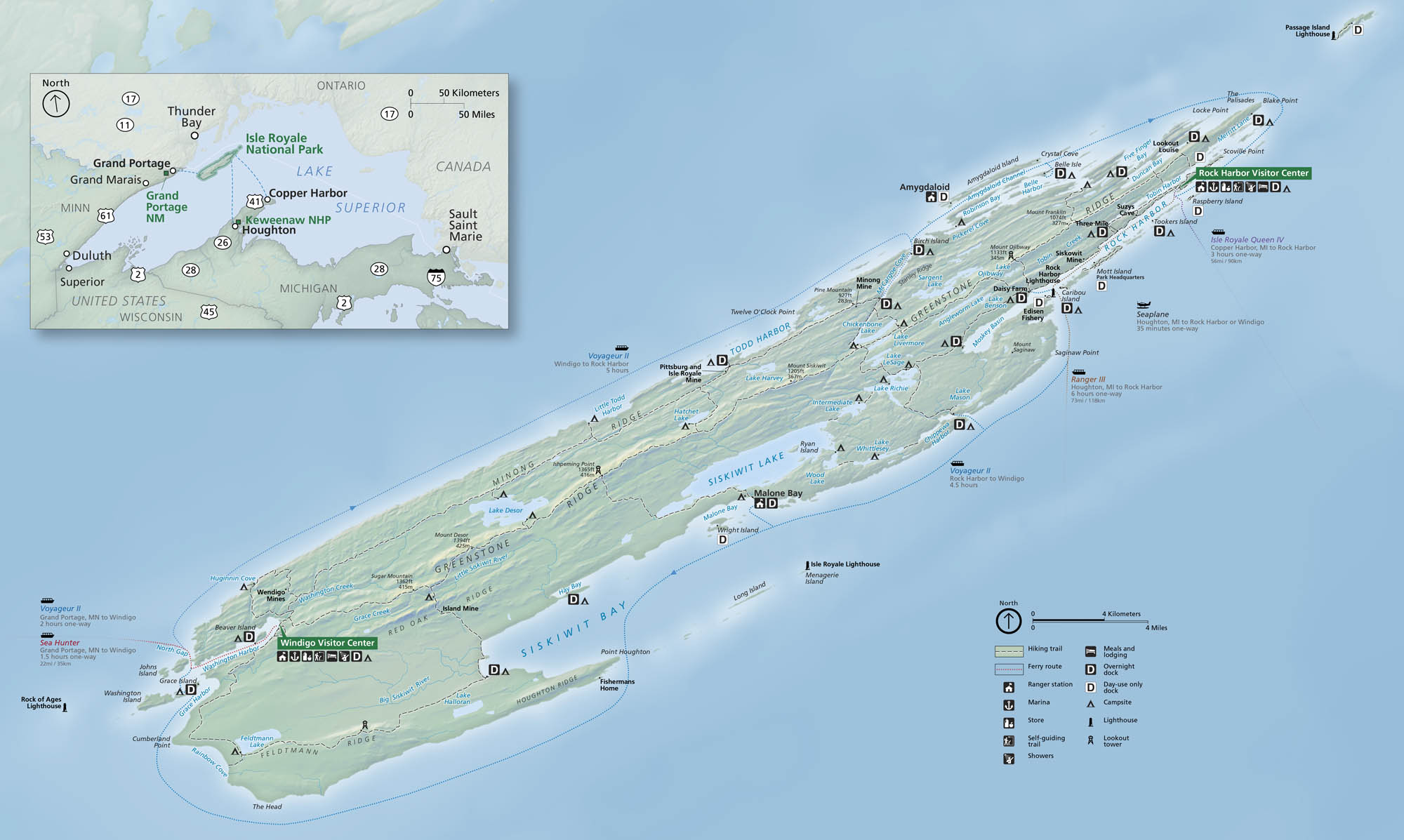
Isle Royale National Park sits far out in Lake Superior, and it kind of feels completely cut off from the rest of the world. Remote forests, rocky shorelines, and quiet inland lakes shape the entire island chain. On our map, you’ll find ferry landings, trails, campgrounds, and much more.
Map Information
On the Map
Parks: Isle Royale National Park, Grand Portage NM, Keweenaw NHP Visitor Centers: Rock Harbor Visitor Center, Windigo Visitor Center Lakes and Harbors: Lake Superior, Siskiwit Lake, Lake Desor, Lake Richie, Lake Halloran, Siskiwit Bay, Todd Harbor, Rock Harbor, Washington Harbor, McCargoe Cove, Tobin Harbor, Duncan Bay, Pickerel Cove, Intermediate Lake, Sargent Lake, Chickenbone Lake, Lake Harvey, Lake Lesage, Lake Livermore, Lake Whittlesey Cities/Towns: Thunder Bay, Grand Portage, Grand Marais, Copper Harbor, Houghton, Sault Saint Marie Campgrounds/Park Sites: Daisy Farm, Mott Island, Rock Harbor Lodge, Windigo, Huginnin Cove, Feldtmann Lake, Malone Bay, Chickenbone Lake, McCargoe Cove, Belle Isle Other Landmarks: Greenstone Ridge, Minong Ridge, Red Oak Ridge, Houghton Ridge, Isle Royale Lighthouse, Rock of Ages Lighthouse, Passage Island Lighthouse, Menagerie Island, Scoville Point, Blake Point, Mount Desor, Mount Ojibway, Ishpeming PointNational Park Maps
Find maps of green spaces and national parks near you.


