Joshua Tree National Park Map
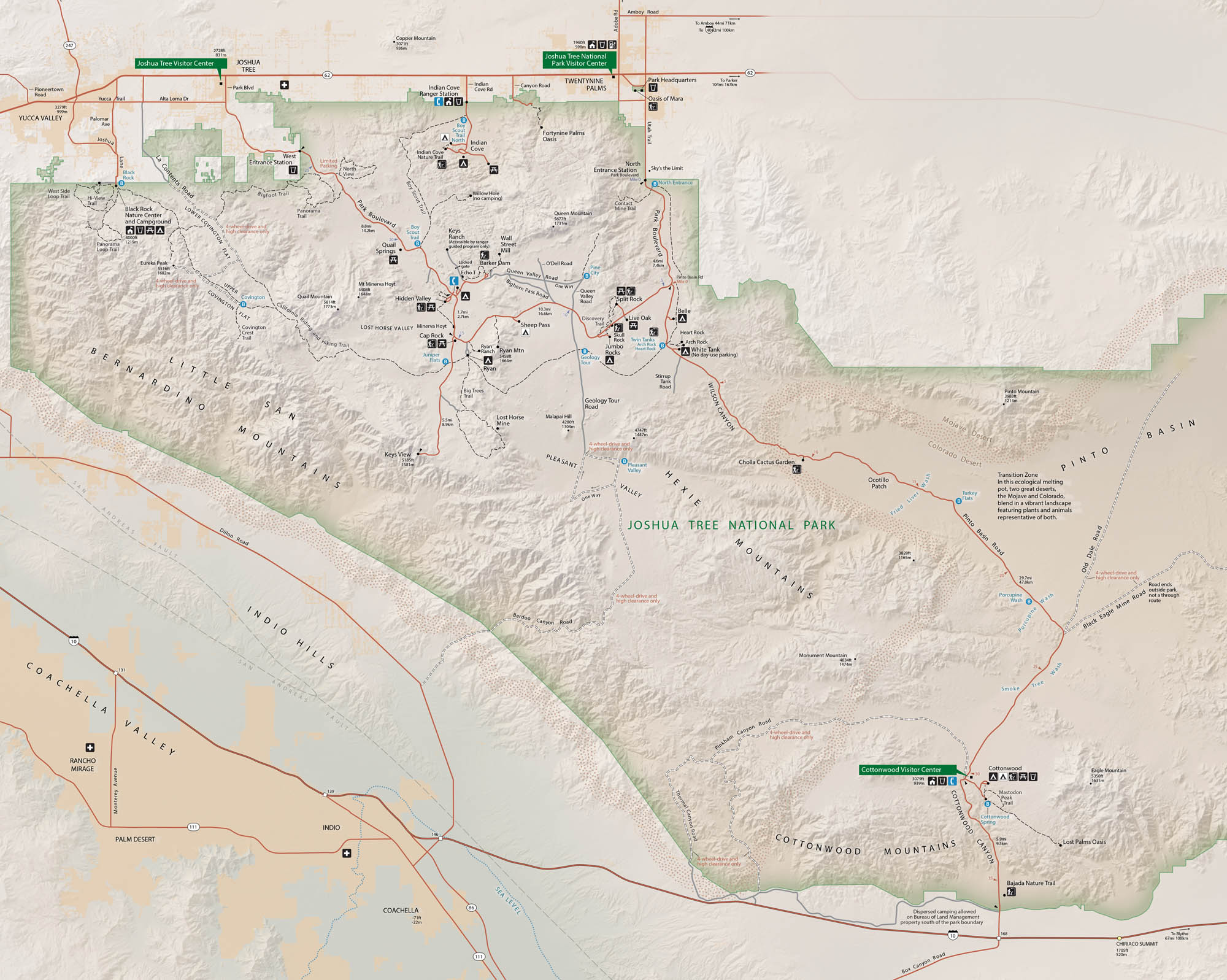
Joshua Tree National Park feels like another planet. Set in southern California, it has massive boulders, desert basins, and the park’s iconic twisted trees. Our map shows roads, trails, campgrounds and much more.
Map Information
On the Map
Interstates/Highways: I-10, US Hwy 62 Major Roads: Park Blvd, Pinto Basin Rd, Wilson Canyon Rd, Keys View Rd, Geology Tour Rd, Gold Park Rd, Old Dale Rd, Black Eagle Mine Rd, Berdoo Canyon Rd, Pinkham Canyon Rd, Covington Flats Rd Visitor Centers: Joshua Tree Visitor Center, Joshua Tree National Park Visitor Center, Cottonwood Visitor Center, Black Rock Nature Center Cities/Towns: Twentynine Palms, Joshua Tree, Yucca Valley, Desert Hot Springs, Palm Springs, Indio, Coachella, Mecca, Chiriaco Summit Campgrounds/Park Sites: Black Rock Campground, Indian Cove Campground, Hidden Valley Campground, Ryan Campground, Sheep Pass Campground, Jumbo Rocks Campground, Belle Campground, White Tank Campground, Cottonwood Campground, Keys Ranch, Lost Horse Mine, Desert Queen Mine, Wall Street Mill Other Landmarks: Little San Bernardino Mountains, Hexie Mountains, Pinto Mountains, Eagle Mountains, Coxcomb Mountains, Cottonwood Mountains, San Andreas Fault, Coachella Valley, Pinto Basin, Pleasant Valley, Queen Valley, Lost Horse Valley, Hidden ValleyNational Park Maps
Find maps of green spaces and national parks near you.


