Kenai Fjords National Park Map
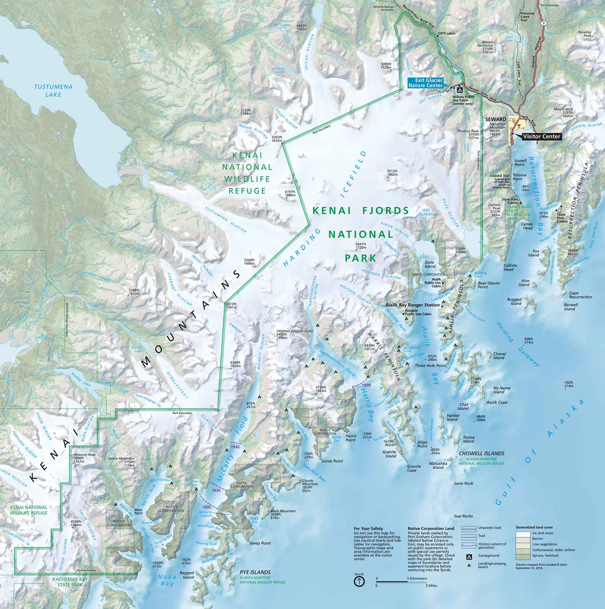
Kenai Fjords National Park hugs Alaska’s southern coast, filled with fjords, wildlife, and icy waters. Our park map shows trails, waterways, visitor centers, and campgrounds.
Map Information
On the Map
Major Highways: Seward Hwy, State Rte 9 Major Roads: Herman Leirer Rd, Nash Road Lakes/Bays: Gulf of Alaska, Resurrection Bay, Aialik Bay, Harris Bay, Nuka Bay, McCarty Fjord, Northwestern Fjord, Skilak Lake, Tustumena Lake, Bear Lake, Delight Lake, Desire Lake Parks: Kenai Fjords National Park, Kenai National Wildlife Refuge, Kachemak Bay State Park, Alaska Maritime National Wildlife Refuge Visitor Centers: Kenai Fjords National Park Visitor Center, Exit Glacier Nature Center Cities/Towns: Seward Campgrounds/Park Sites: Exit Glacier Campground, Willow Public Use Cabin, Aialik Public Use Cabin, Holgate Public Use Cabin, Coastal Trail Other Landmarks: Harding Icefield, Kenai Mountains, Exit Glacier, Bear Glacier, Aialik Glacier, Northwestern Glacier, McCarty Glacier, Resurrection Peninsula, Aialik Peninsula, Harris Peninsula, Chiswell Islands, Pye Islands, Mount Marathon, Phoenix Peak, Callisto PeakNational Park Maps
Find maps of green spaces and national parks near you.


