Kobuk Valley National Park Map
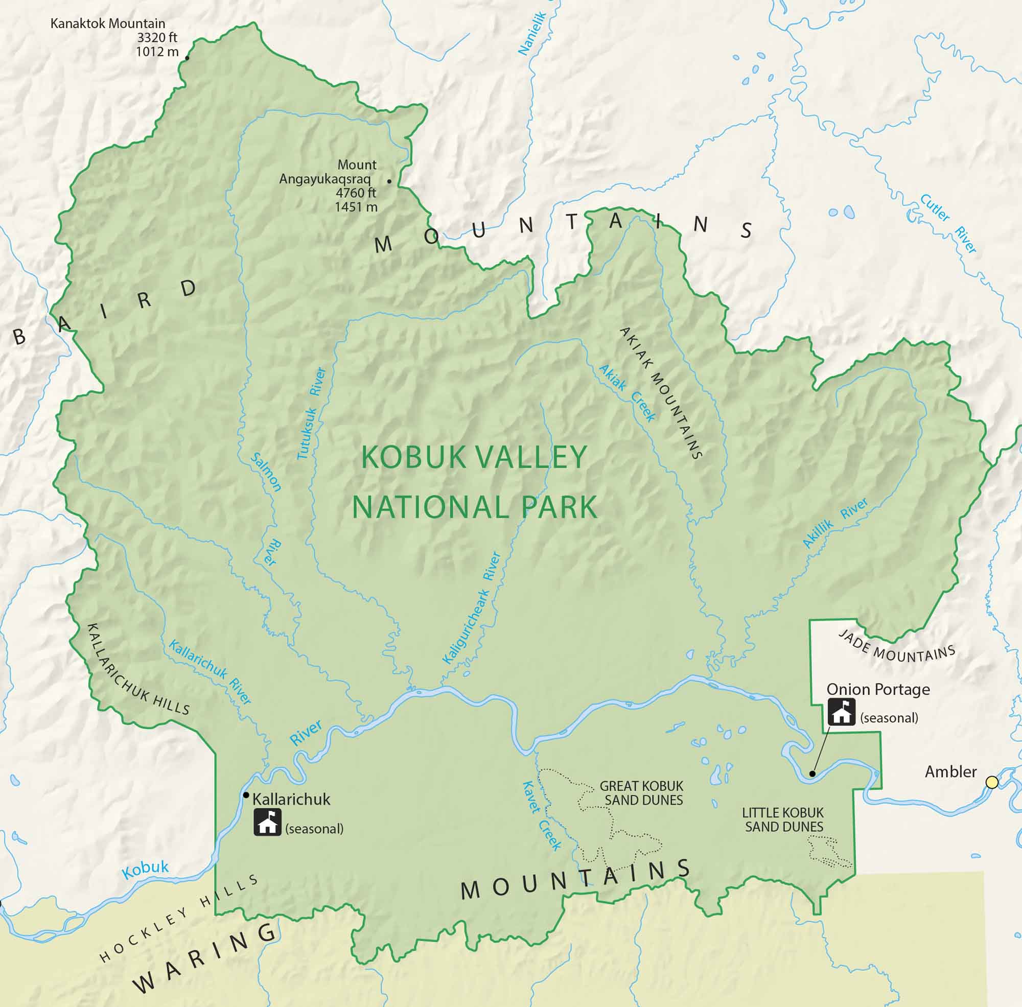
Kobuk Valley National Park lies in northwestern Alaska, home to caribou herds and sand dunes. Vast tundra stretches endlessly here. Our park map highlights seasonal ranger stations, sand dunes and rivers for exploring this remote wilderness.
Map Information
On the Map
Parks: Kobuk Valley National Park Park Sites: Onion Portage, Kallarichuk Rivers/Creeks: Kobuk River, Salmon River, Tutuksuk River, Hunt River, Akillik River, Kallarichuk River, Kaliguricheark River, Kavet Creek, Akiak Creek, Nanielek River, Cutler River Cities/Towns: Ambler, Kobuk, Kiana Other Landmarks: Great Kobuk Sand Dunes, Little Kobuk Sand Dunes, Baird Mountains, Waring Mountains, Jade Mountains, Akiak Mountains, Kallarichuk Hills, Hockley Hills, Mount Angayukaqsraq, Kanaktok MountainNational Park Maps
Find maps of green spaces and national parks near you.


