Lassen Volcanic National Park Map
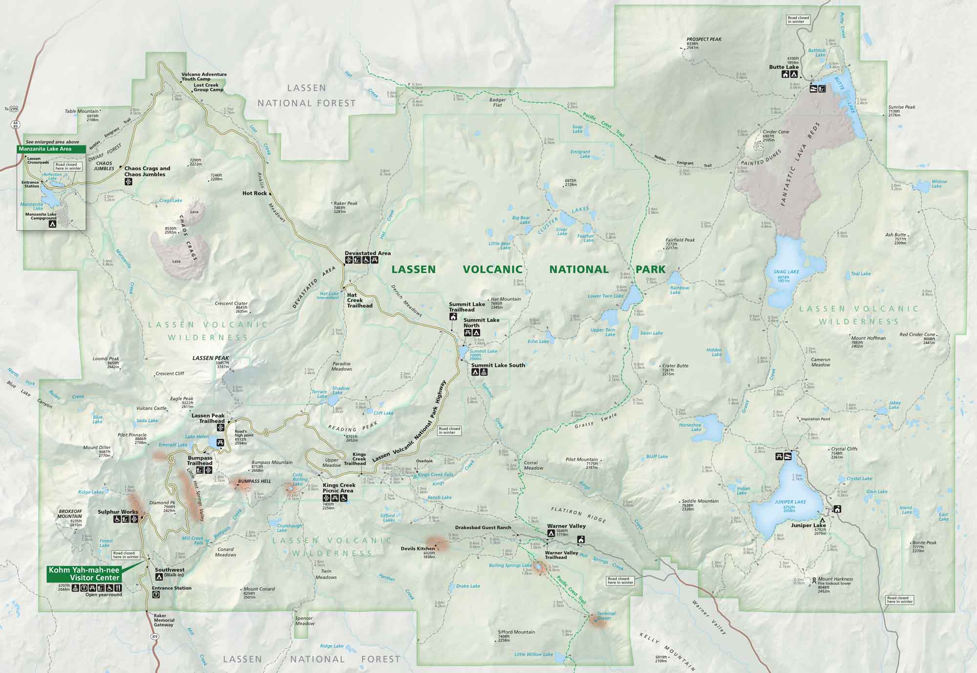
Located in northern California, Lassen Volcanic National Park is full of geothermal life. Our park map displays its roads, trails, campgrounds, and much more.
Map Information
On the Map
Parks: Lassen National Forest, Lassen Volcanic Wilderness Visitor Centers: Kohm Yah-mah-nee Visitor Center Major Roads: Lassen Volcanic National Park Hwy Rivers/Lakes/Bays/Reservoirs/Oceans: Manzanita Lake, Reflection Lake, Crags Lake, Blue Lake, Ridge Lakes, Emerald Lake, Lake Helen, Soda Lake, Shadow Lake, Terrace Lake, Cliff Lake, Crumbaugh Lake, Summit Lake, Echo Lake, Upper Twin Lake, Lower Twin Lake, Swan Lake, Rainbow Lake, Snag Lake, Juniper Lake Campgrounds/Park Sites: Manzanita Lake Campground, Volcano Adventure Youth Camp, Lost Creek Group Camp, Summit Lake North, Summit Lake South, Warner Valley, Juniper Lake Campground, Southwest (Walk-in), Drakesbad Guest Ranch Other Landmarks: Chaos Jumbles, Chaos Crags, Lassen Peak, Bumpass Hell, Sulphur Works, Devastated Area, Kings Creek Falls, Devils Kitchen, Boiling Springs Lake, Terminal Geyser, Cinder Cone, Painted Dunes, Fantastic Lava BedsNational Park Maps
Find maps of green spaces and national parks near you.


