New River Gorge National Park Map
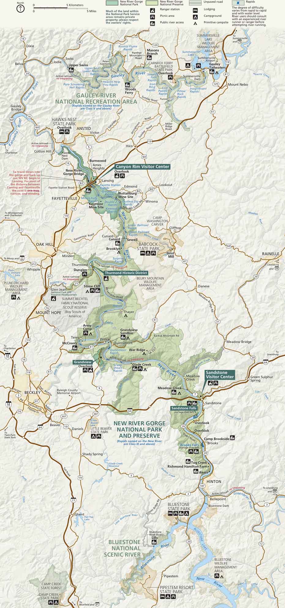
Adventure starts in this carved-out canyon. Located in southern West Virginia, the river cuts through cliffs, forests, and historic rail towns. Our New River Gorge National Park map marks roads, trails, campgrounds, and scenic pull-offs.
Map Information
On the Map
Parks: New River Gorge National Park and Preserve, Gauley River National Recreation Area, Bluestone National Scenic River, Hawks Nest State Park, Babcock State Park, Bluestone State Park, Pipestem Resort State Park, Carnifex Ferry Battlefield State Park Visitor Centers: Canyon Rim Visitor Center, Thurmond Historic District, Sandstone Visitor Center, Grandview Interstates/Highways: I-64, I-77, US Hwy 19, US Hwy 60, State Rte 41, State Rte 16, State Rte 20, State Rte 82, State Rte 3, State Rte 107 Major Roads: Fayette Station Rd, Gatewood Rd, Backus Mountain Rd Rivers/Lakes/Bays/Reservoirs/Oceans: New River, Gauley River, Bluestone River, Summersville Lake, Bluestone Lake, Meadow River, Greenbrier River Cities/Towns: Beckley, Hinton, Fayetteville, Mount Hope, Oak Hill, Ansted, Gauley Bridge, Meadow Bridge, Rainelle, Hico, Prince Campgrounds/Park Sites: Grandview Sandbar, Army Camp, Stone Cliff, Thayer, Glade Creek, War Ridge, Brooklyn, Cunard, Gauley Tailwaters Other Landmarks: New River Gorge Bridge, Kaymoor Mine Site, Nuttallburg Mine Site, Grist Mill, Sandstone Falls, Bluestone Dam, Hawks Nest DamNational Park Maps
Find maps of green spaces and national parks near you.


