Petrified Forest National Park Map
Petrified Forest National Park feels otherworldly. Stretching across northeastern Arizona, our park map shows trails, roads, overlooks and more.
Map Information
On the Map
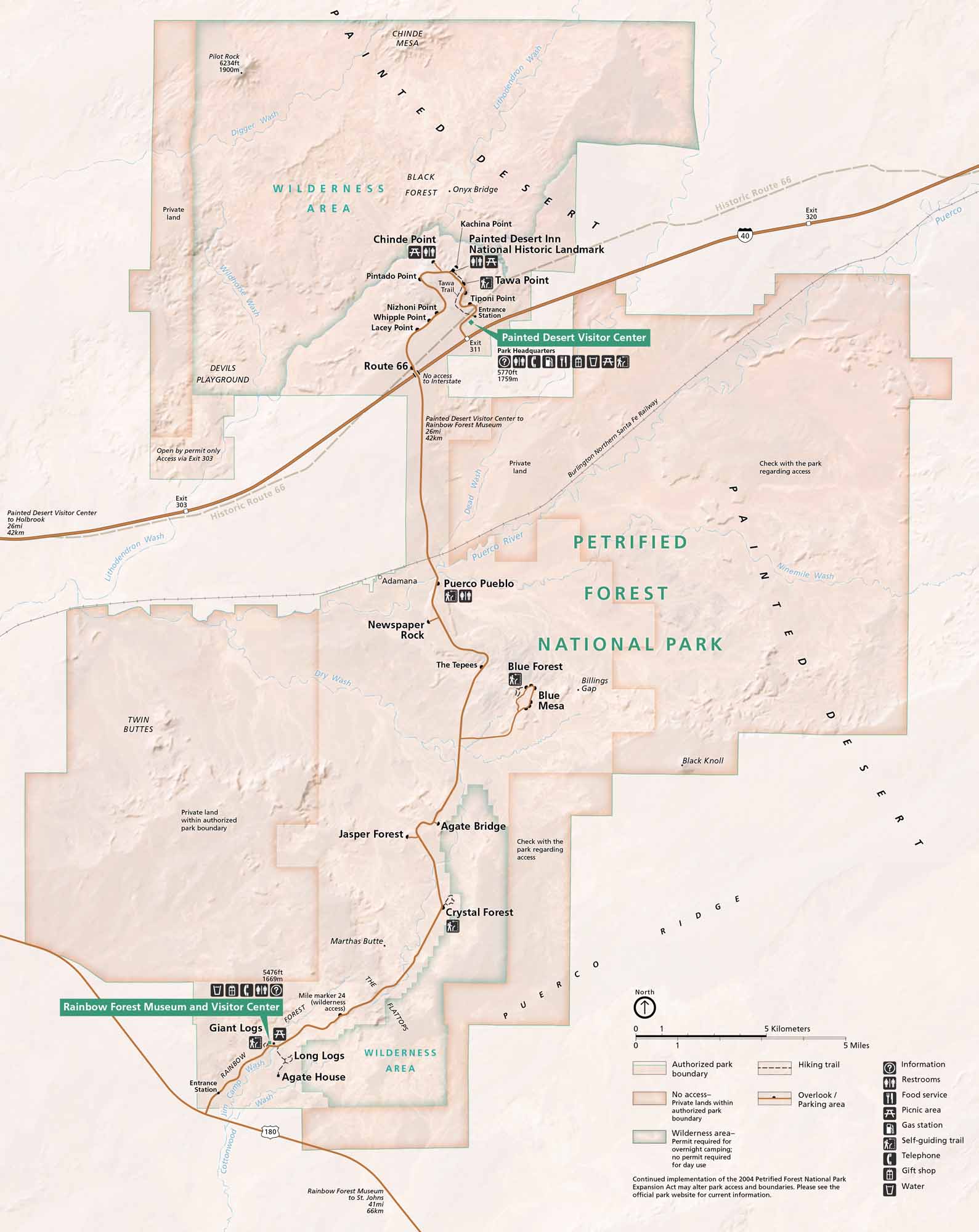
Parks: Petrified Forest National Park Wilderness Area Visitor Centers: Painted Desert Visitor Center, Rainbow Forest Museum and Visitor Center Highways and Roads: I-40, US Hwy 180, Historic Route 66 Rivers/Lakes/Bays/Reservoirs/Oceans: Puerco River, Lithodendron Wash, Dead Wash, Dry Wash, Cottonwood Wash Cities/Towns: Holbrook, St. Johns, Adamana Park Sites: Painted Desert Inn National Historic Landmark Other Landmarks: Painted Desert, Black Forest, Blue Mesa, Jasper Forest, Crystal Forest, Giant Logs, Long Logs, Agate House, Agate Bridge, Newspaper Rock, Puerco Pueblo, The Tepees, Blue Forest, Kachina Point, Tawa Point, Tiponi Point, Pintado Point, Nizhoni Point, Whipple Point, Lacey PointNational Park Maps
Find maps of green spaces and national parks near you.


