Redwood National and State Parks Map
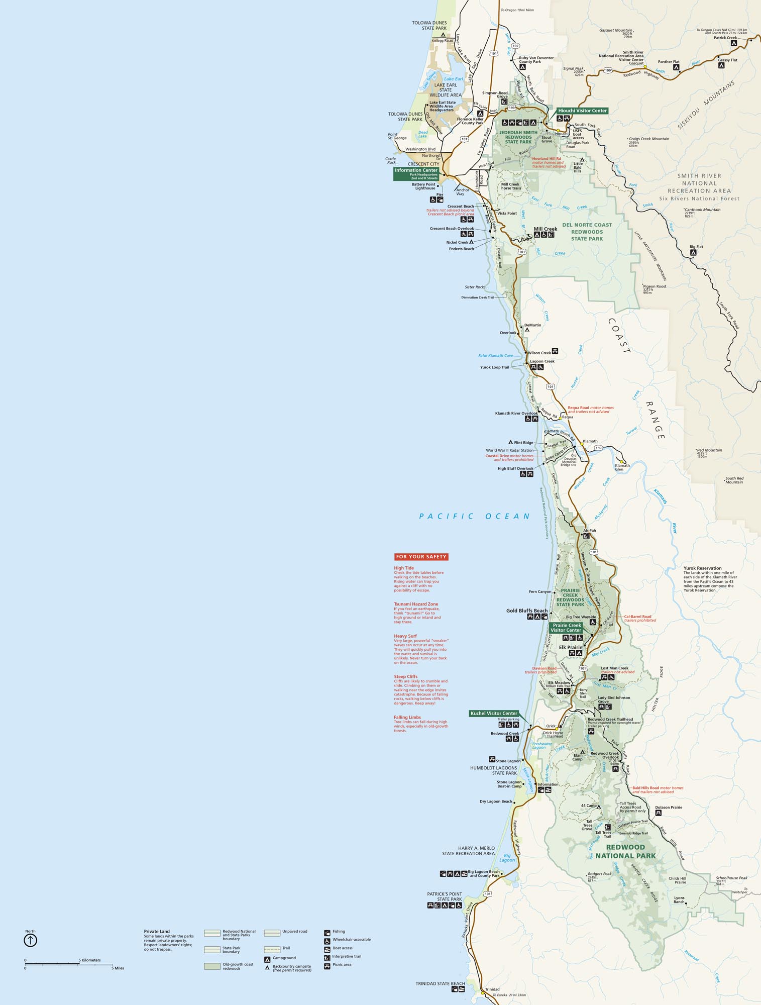
Our map highlights Redwood National and State Parks packed with the tallest trees on Earth. Highway 101 and Newton B. Drury Scenic Parkway cut through the park. These monster redwoods thrive in the foggy coastal strip of far northern California.
Map Information
On the Map
Parks: Redwood National Park, Jedediah Smith Redwoods State Park, Del Norte Coast Redwoods State Park, Prairie Creek Redwoods State Park, Harry A. Merlo State Recreation Area, Tolowa Dunes State Park Visitor Centers: Hiouchi Visitor Center, Jedediah Smith Visitor Center, Crescent City Information Center, Prairie Creek Visitor Center, Kuchel Visitor Center Roads and Highways: US Hwy 101, US Hwy 199, Coastal Dr, Newton B. Drury Scenic Pkwy, Bald Hills Rd, Requa Rd, Terwer Valley Rd, Kings Valley Rd Rivers/Lakes: Pacific Ocean, Klamath River, Smith River, Lake Earl, Lake Talawa, Redwood Creek, Lagoon Creek, Crescent Bay Cities/Towns: Crescent City, Hiouchi, Requa, Klamath, Orick, Trinidad Campgrounds/Park Sites: Jedediah Smith Campground, Mill Creek Campground, Elk Prairie Campground, Gold Bluffs Beach, Gold Bluffs Beach Campground, 44 Camp, Flint Ridge, DeMartin Other Landmarks: Battery Point Lighthouse, High Bluff Overlook, Lady Bird Johnson Grove, Tall Trees Grove, Fern Canyon, Big Tree Wayside, Klamath River Overlook, Skunk Cabbage TrailNational Park Maps
Find maps of green spaces and national parks near you.


