Rocky Mountain National Park Map
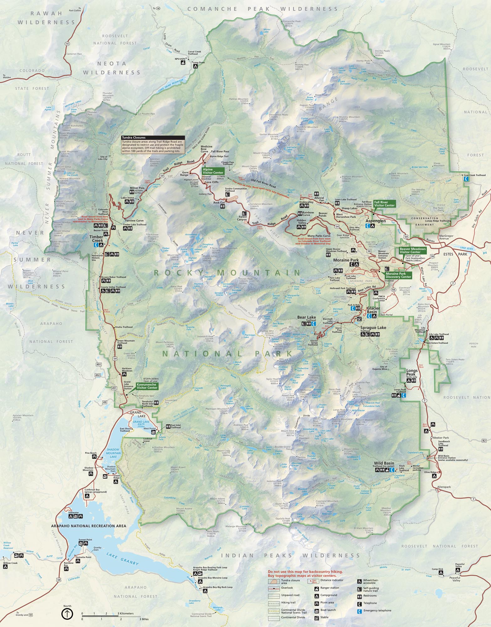
Here’s our map of Rocky Mountain National Park. You’ll see Trail Ridge Road slicing through the peaks. There’s also campgrounds, picnic areas, restrooms and visitor centers.
Map Information
On the Map
Parks: Rocky Mountain National Park, Arapaho National Recreation Area Visitor Centers: Alpine Visitor Center, Beaver Meadows Visitor Center, Fall River Visitor Center, Kawuneeche Visitor Center, Moraine Park Discovery Center Highways/Roads: Trail Ridge Rd, US Hwy 34, US Hwy 36, Bear Lake Rd, State Rte 7, Fall River Rd, Old Fall River Rd, Long Draw Rd Rivers/Lakes: Lake Granby, Shadow Mountain Lake, Grand Lake, Bear Lake, Sprague Lake, Dream Lake, Haiyaha Lake, Fern Lake, Odessa Lake, Lawn Lake, Crystal Lake, Blue Lake, Mirror Lake, Poudre River, Colorado River, Big Thompson River Cities/Towns: Estes Park, Grand Lake Park Sites: Moraine Park, Glacier Basin, Aspenglen, Timber Creek, Longs Peak, Wild Basin, Endovalley, Sprague Lake, Bear Lake Parking Other Landmarks: Longs Peak, Continental Divide, Mummy Range, Never Summer Mountains, Gore Range, Milner Pass, Fall River Pass, Forest Canyon, Many Parks Curve, Rainbow CurveNational Park Maps
Find maps of green spaces and national parks near you.


