Map of Sunrise, Florida
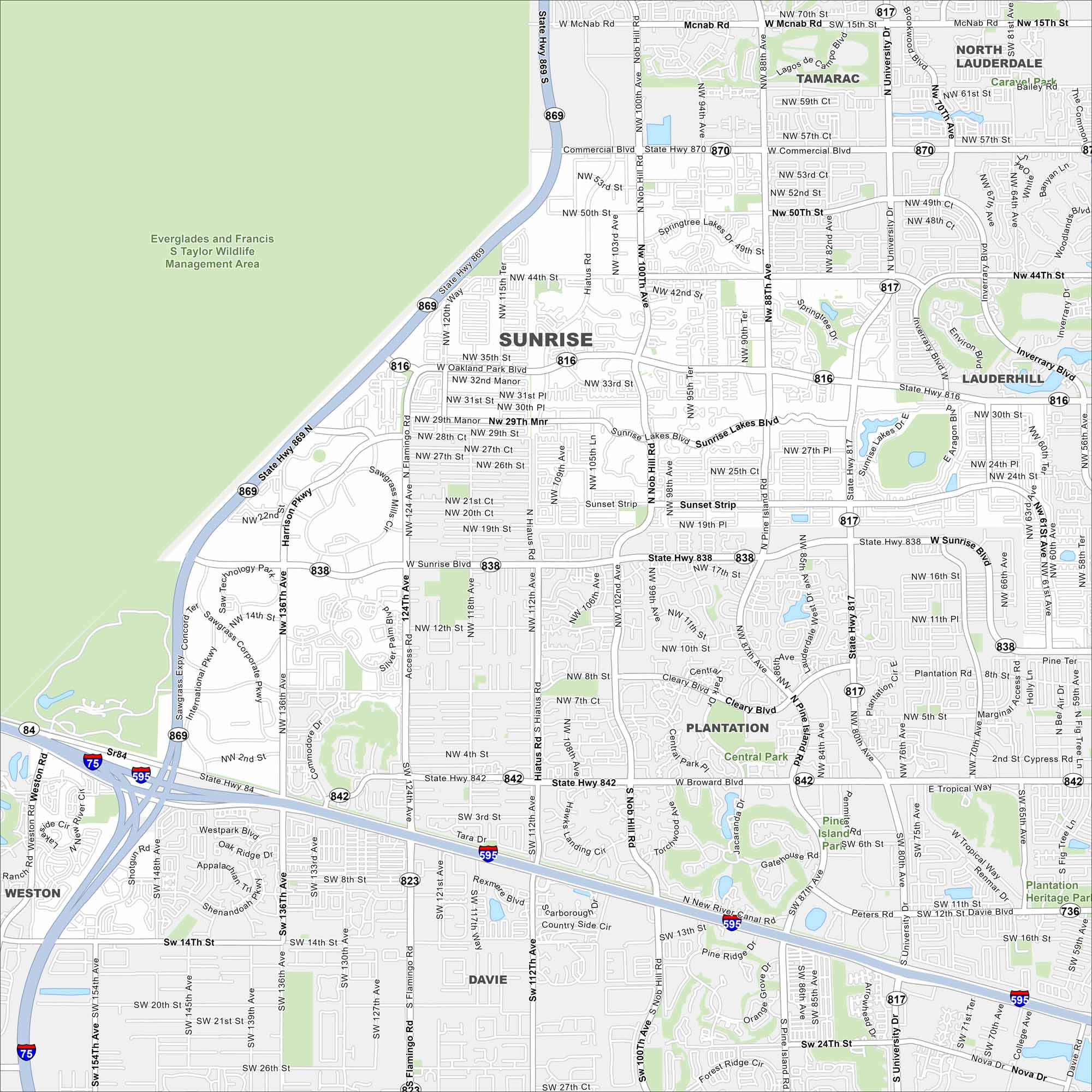
Check out our road map of Sunrise, Florida. It’s home to Sawgrass Mills and the arena where the Florida Panthers play in the National Hockey League (NHL).
Florida State Maps
Discover Florida through our state maps


Map Information
On the Map
Interstates/Highways: I-75, I-595, State Hwy 869, State Hwy 817, State Hwy 838, State Hwy 842, State Hwy 816, State Hwy 870 Major Roads: Sunrise Blvd, University Dr, Nob Hill Dr, Pine Island Rd, Hiatus Rd, Flamingo Rd, Commercial Blvd, Oakland Park Blvd, Broward Blvd, Sawgrass Expy, Harrison Pkwy, NW 136th Ave, NW 124th Ave, NW 108th Ave, NW 94th Ave, NW 64th Ave, NW 50th St, NW 44th St, NW 8th St, Sunset Strip Parks and Preserves: Everglades and Francis S Taylor Wildlife Management Area, Central Park, Plantation Heritage Park, Pine Island Park Nearby Communities: Tamarac, North Lauderdale, Lauderdale Lakes, Lauderhill, Plantation, Davie, WestonFlorida City Maps
Chart your course through Miami and Florida’s cities


